Category:Maps of the Chukchi Sea
Jump to navigation
Jump to search
Media in category "Maps of the Chukchi Sea"
The following 31 files are in this category, out of 31 total.
-
 1598 map of the Polar Regions by Willem Barentsz.jpg 13,719 × 10,160; 30.66 MB
-
 Aleuten Lage-blank.png 707 × 545; 703 KB
-
 Aleuten Lage-he.png 884 × 681; 867 KB
-
 Barents third voyage.jpg 2,000 × 1,511; 965 KB
-
 Barentskartet, 1598 (12068020364).jpg 2,842 × 2,091; 3.85 MB
-
 Barentsz Full Map.jpg 1,000 × 742; 258 KB
-
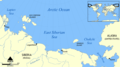
 Chukchi Sea af.png 896 × 570; 167 KB
-
 Chukchi Sea hr.svg 1,004 × 639; 317 KB
-
 Chukchi Sea hu.svg 1,195 × 760; 210 KB
-
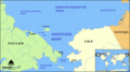
 Chukchi Sea map ar.png 1,202 × 675; 229 KB
-
 Chukchi Sea map-et.png 750 × 422; 130 KB
-
 Chukchi Sea map-fr.svg 1,202 × 675; 343 KB
-
 Chukchi Sea map-sv.png 1,200 × 672; 234 KB
-
 Chukchi Sea map.png 1,200 × 672; 100 KB
-
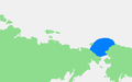
 Chukchi Sea.png 896 × 570; 110 KB
-
 East Siberian Sea map hr.svg 997 × 554; 413 KB
-
 East Siberian Sea map hu.svg 1,589 × 884; 194 KB
-
 East Siberian Sea map.png 1,192 × 663; 116 KB
-
 Forminsket utgave av Barentskartet - no-nb krt 00487.jpg 4,418 × 3,449; 3.45 MB
-

-

-
 Karluk voyage map-ar.png 1,002 × 672; 292 KB
-
 Karluk voyage map.png 1,002 × 672; 198 KB
-
 Operational Navigation Chart C-8, 2nd edition.jpg 9,060 × 6,634; 14.37 MB
-
 Operational Navigation Chart C-9, 6th edition.jpg 9,053 × 6,596; 18.9 MB
-
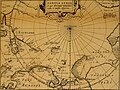 Pontanus 1611 Arctic Map.jpg 2,852 × 2,142; 802 KB
-
 Smith Bay map.jpg 3,300 × 2,550; 2.55 MB
-
 Tsjoektsjenzee.PNG 817 × 508; 14 KB
-
 Txu-oclc-6654394-nr-1-2-2nd-ed.jpg 5,488 × 4,531; 2.7 MB
-
 Voyage du Karluk.svg 1,202 × 675; 634 KB
-
 Чукотское море на карте.png 1,200 × 672; 263 KB


.jpg)


_door_Willem_Barendsz_(titel_op_object),_NG-800.jpg)


