Category:Maps of the Canadian Arctic region
Jump to navigation
Jump to search
Maps of the Canadian Arctic region, including the Canadian Arctic Archipelago.
Subcategories
This category has the following 3 subcategories, out of 3 total.
!
M
- Maps of Baffin Island (30 F)
- Maps of Ellesmere Island (22 F)
Media in category "Maps of the Canadian Arctic region"
The following 26 files are in this category, out of 26 total.
-
 Akpatokisland.png 320 × 329; 12 KB
-
-
 Archipelag Arktyczny.png 944 × 890; 457 KB
-
 Arcticisl.png 508 × 410; 14 KB
-
 ArxipèlagÀrticCanadenc.png 700 × 675; 98 KB
-
 Boothia Peninsula and North Somerset map.jpg 1,247 × 1,146; 92 KB
-
 Canad arctic islands J.PNG 900 × 675; 86 KB
-
 Canadarcticislands.gif 700 × 675; 117 KB
-
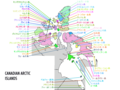
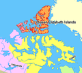
 Canadian Arctic Islands-el.png 727 × 513; 109 KB
-
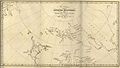
 Coppermine expedition map.jpg 1,250 × 1,142; 121 KB
-
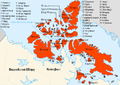
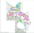 Image for Arctic Archipelago Quiz.png 700 × 675; 178 KB
-
 Inuvialiut communities -3.png 513 × 412; 26 KB
-
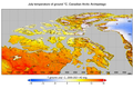 July temperature of gound canadian arctic islands 1.png 1,328 × 880; 1,012 KB
-
 July temperature of gound ellesmere island 1.png 1,392 × 928; 932 KB
-
 Lancasteri väin.svg 407 × 394; 245 KB
-
 Loksland.png 320 × 329; 12 KB
-

-
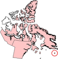
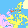 Map indicating Melville Island, northern Canada.png 375 × 375; 54 KB
-
 Map indicating Parry Channel.PNG 428 × 380; 35 KB
-
-
 Map indicating Victoria Island, northern Canada.png 428 × 380; 67 KB
-
 Map Remains of Franklin's Lost Expedition.svg 709 × 1,248; 2.73 MB
-
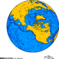
 Orthographic projection centered over Iqaluit.png 488 × 487; 18 KB
-
 Orthographic projection over Tuktoyaktuk.png 488 × 487; 18 KB
-
 Supposed Route of Franklin's expedition 1845-1848.svg 999 × 700; 1.6 MB
-
 Sverdrup islands.gif 700 × 675; 45 KB

_(3752049533).jpg)


_Islands,_northern_Canada.png)


