Category:Maps of the Byzantine empire in the 4th century
Jump to navigation
Jump to search
Media in category "Maps of the Byzantine empire in the 4th century"
The following 8 files are in this category, out of 8 total.
-
 4KTHEODOSIAN.png 3,840 × 2,160; 555 KB
-
 Alter Orient 0400AD.svg 2,102 × 1,510; 4.96 MB
-
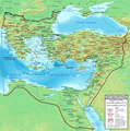 Eastern Roman Empire ca. 400 AD.png 1,425 × 1,437; 1.9 MB
-
 Eastern Roman Empire with West.png 3,998 × 1,835; 609 KB
-
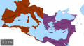
 Eastern Roman Empire.png 3,998 × 1,835; 601 KB
-
 Invasi bangsa barbar ke Romawi.svg 1,800 × 1,300; 236 KB
-
 Invasions of the Roman Empire 1.png 1,954 × 1,382; 269 KB
-
 Logo Ostrom 395.png 1,377 × 1,272; 159 KB


