Category:Maps of the Brahmaputra
Jump to navigation
Jump to search
Media in category "Maps of the Brahmaputra"
The following 61 files are in this category, out of 61 total.
-

-
 'Front of Tibet' Map Painted by Wu Run-De (1907).jpg 1,000 × 827; 299 KB
-
-

-
-

-
 1865 Spruner Map of India and Southeast Asia - Geographicus - India-spruner-1865.jpg 3,500 × 2,890; 2.26 MB
-
 (1882) MAP OF THE TRIBES OF INDIA.jpg 2,634 × 2,158; 1.57 MB
-
 1913 North-Eastern Frontier and Tibet by Morshead and Bailey from RE Journal 1921.jpg 5,733 × 4,158; 3.12 MB
-
 1930 Map of the Republic of China.JPG 1,171 × 817; 272 KB
-
 Allied lines of communication in Southeast Asia, 1942-43.jpg 1,260 × 970; 450 KB
-
 Allied Third Burma Campaign Apri 1-May 1945.jpg 1,260 × 970; 270 KB
-
 Brahmaputra system.png 1,047 × 501; 604 KB
-
 Brahmaputra Valley map.png 1,549 × 1,080; 78 KB
-
 Brahmaputra-river-basin.png 2,573 × 1,956; 848 KB
-
 Brahmaputra-verlaufsgebiet.jpg 1,280 × 836; 296 KB
-
 Brahmaputrarivermap.png 449 × 381; 308 KB
-
 Calotes medogensis distribution.png 1,259 × 944; 2.61 MB
-

-
 Central Asian trade routes.jpg 954 × 674; 206 KB
-
 Chaksam (Iron Bridge in transliteration from Tibetan to English).png 1,223 × 705; 236 KB
-
 Chwanpien.jpg 1,600 × 1,184; 393 KB
-
 Ganges-Brahmaputra-Meghna basins.jpg 1,403 × 777; 1.09 MB
-
 GangesBramhaputraMeghnaBasin Bengali By Sumita Roy.png 1,053 × 745; 243 KB
-
 Geology of Everest region, 1921.jpg 6,084 × 3,888; 5.51 MB
-
-

-
 Map India and Pakistan 1-250,000 Tile NH 46-16 Nizamghat.jpg 5,000 × 3,852; 3.98 MB
-

-
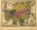
 Map of Asia, Mitchell's School Atlas LOC 2007633727-13 (cropped).jpg 3,117 × 2,378; 1.79 MB
-

-
-

-

-
 Map of Tibet detail from China old map 1936 (cropped).jpg 504 × 391; 115 KB
-
 Map of Tibet in 1782, Hindoostan (20118721954) (cropped).jpg 1,114 × 455; 593 KB
-
 Map of Tibet in 1798, from- Map China c1798 (cropped).jpg 348 × 255; 40 KB
-
 Map of Tibet in 1821 Carey Map of India - Geographicus - India-carey-1821 (cropped).jpg 1,942 × 1,062; 541 KB
-
 Map of Tibet in 1855 from Vorder-Indien oder das Indo-Britische Reich (cropped).jpg 3,475 × 1,630; 2.64 MB
-

-
-

-
-

-

-

-

-
 Mitchell's school atlas LOC 2007633727-13.jpg 3,402 × 2,814; 1.97 MB
-
 Mitchell's school atlas LOC 2007633727-13.tif 3,402 × 2,814; 27.39 MB
-
 Pantholops hodgsonii distribution.png 1,259 × 944; 2.49 MB
-
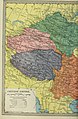
 Physical map of Tibet.png 833 × 490; 446 KB
-
 Preliminary map of Mount Everest Expedition, 1921. Map I.jpg 6,284 × 3,900; 2.22 MB
-
 Raidak River map.png 714 × 523; 386 KB
-
-

-
 TibetanPlateau.jpg 720 × 481; 329 KB
-
 Topografic map of Tibetan Plateau.png 1,365 × 732; 663 KB
-
 Txu-pclmaps-oclc-22834566 h-10a.jpg 9,264 × 6,761; 17.79 MB
-
 Vorder-Indien oder das Indo-Britische Reich.jpg 5,683 × 4,568; 8.96 MB
-
 Yangtze River drainage basin map.svg 943 × 498; 9.6 MB
-
 Yarlung Tsangpo map.png 1,706 × 1,111; 1.58 MB
_(cropped).jpg)
.jpg)
.jpg)
%27_(11180098823).jpg)
,_map_of_Ladakh_(Petit_Thibet)_and_Map_of_Nepal_(Nepaul)_detail,_from-_Carte_des_sources_du_Gange,_de_l%27Indus_et_du_Broumapouter_au_nord_de_l%27Indoustan_et_au_Thibet_(34203873250)_(cropped).jpg)


_MAP_OF_THE_TRIBES_OF_INDIA.jpg)


.jpg)


_(14784338845).jpg)
,_Litang,_Gyaltang,_Kham,_Tibet-_Burma_Road_terminus_at_Kunming,_China_1945_map_detail,_from-_Allied_Third_Burma_Campaign_Apri_1-May_1945_(cropped).jpg)

_with_Lhasa_(Lassa)_capitol_and_India_(Hindoostan)_with_Calcutta_capitol_in_1839_from_Mitchell%27s_School_Atlas_LOC_2007633727-13_(cropped).jpg)
.jpg)
_and_the_Himalayas_in_1885_from_12_of_%27The_Imperial_Gazetteer_of_India_..._Second_edition_(revised_and_enlarged)%27_(11180098823)_(cropped).jpg)
.jpg)
.jpg)
.JPG)
.jpg)
.jpg)
.jpg)
.jpg)
_(14576990459)_(cropped).jpg)
_(cropped).jpg)
.jpg)
.jpg)
_(cropped).jpg)
.jpg)

.jpg)


_(14576990459).jpg)
.jpg)


.png)
_(cropped).jpg)