Category:Maps of the Bay of Fundy
Jump to navigation
Jump to search
Media in category "Maps of the Bay of Fundy"
The following 44 files are in this category, out of 44 total.
-
-

-

-
 Admiralty Chart No 1857 Bay of Fundy L'Etang (Letang) Harbour, Published 1848.jpg 8,105 × 6,114; 9.15 MB
-
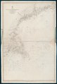
 Admiralty Chart No 2492 Bay of Fundy to Block Island, Published 1857.jpg 8,130 × 11,946; 7.64 MB
-
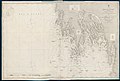 Admiralty Chart No 2537 Bay of Fundy East Coast Pubnico to Yarmouth, Published 1857.jpg 11,934 × 8,029; 15.39 MB
-
 Admiralty Chart No 2538 Bay of Fundy Yarmouth to Petit Passage, Published 1858.jpg 8,113 × 11,923; 10.69 MB
-
 Admiralty Chart No 2539 Bay of Fundy Grand Manan Island, Published1857.jpg 8,074 × 11,957; 7.15 MB
-
 Admiralty Chart No 2561 Bay of Fundy from Gulliver Hole to St Croix Bay, Published 1858.jpg 11,855 × 8,074; 13.54 MB
-
 Admiralty Chart No 2656 Bay of Fundy East Coast Bryer Island to Gulliver Hole, Published 1859.jpg 12,034 × 8,230; 11.31 MB
-
 Admiralty Chart No 339 Nova Scotia Baccaro Point to Pubnico Harbour, Published 1857.jpg 11,934 × 8,029; 13.34 MB
-
 Admiralty Chart No 352 North America East Coast Sheet 1 Bay of Fundy, Published 1865.jpg 7,997 × 11,964; 13.13 MB
-

-
 Admiralty Chart No 354 Bay of Fundy River Petitcoudiac and Cumberland Basin, Published 1863.jpg 11,833 × 8,163; 22.84 MB
-
 Bay of Fundy (3046333904).jpg 1,593 × 2,000; 3.06 MB
-
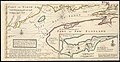
 Description of the Coasts, Points, Harbours and Islands of New France WDL280.png 9,652 × 6,783; 94.71 MB
-
 FMIB 36801 Hauteurs moyennes des Marees dans la Baie de Fundy (Canada).jpeg 779 × 1,093; 246 KB
-
 FMIB 43871 Bay of Fundy.jpeg 865 × 689; 196 KB
-
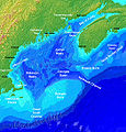 GulfofMaine.jpg 523 × 544; 285 KB
-
 La baye françoise.png 3,409 × 2,121; 12.18 MB
-
-
-
-
-
-
-
-
-
-
 MitchellMap-SouthernNovaScotia.jpg 2,904 × 2,336; 2.6 MB
-
 South-east part of the Bay of Fundy RMG K0473.jpg 1,280 × 495; 396 KB
-
 South-east part of the Bay of Fundy RMG K0475.jpg 1,280 × 483; 448 KB
-
 South-east part of the Bay of Fundy RMG K0476.jpg 1,280 × 501; 442 KB
-
 South-east part of the Bay of Fundy RMG K0477.jpg 1,280 × 527; 492 KB
-
 South-east part of the Bay of Fundy RMG K0478.jpg 1,280 × 503; 432 KB
-
 South-east part of the Bay of Fundy RMG K0479.jpg 1,005 × 1,280; 735 KB
-
 South-east part of the Bay of Fundy RMG K0480.jpg 1,001 × 1,280; 849 KB
-
 South-east part of the Bay of Fundy RMG K0481.jpg 992 × 1,280; 811 KB
-
 South-east part of the Bay of Fundy RMG K0482.jpg 998 × 1,280; 762 KB
-
 Statement-on-the-part-of-the-United-States-Convention-29th-September-1827 MG 9397.tif 3,696 × 3,760; 39.8 MB
-
 Statement-on-the-part-of-the-United-States-Convention-29th-September-1827 MG 9398.tif 3,576 × 3,856; 39.49 MB
-
 Wpdms nasa topo bay of fundy - en.jpg 300 × 230; 25 KB
-
 Wpdms nasa topo bay of fundy.jpg 300 × 230; 15 KB
-
 Wpdms shdrlfi020l bay of fundy.png 300 × 265; 131 KB
.jpg)
_(cropped).jpg)
.jpg)
_Harbour,_Published_1848.jpg)


.jpg)

.jpeg)


