Category:Maps of the Arabian Peninsula
Jump to navigation
Jump to search
English: Maps of the Arabian Peninsula
See also:
Subcategories
This category has the following 11 subcategories, out of 11 total.
Media in category "Maps of the Arabian Peninsula"
The following 67 files are in this category, out of 67 total.
-
 Arabian peninsula definition-Berkay.png 250 × 162; 5 KB
-
 Afrotropic-Arabian Peninsula.svg 2,487 × 2,770; 387 KB
-
 Afrotropic-Ecozone-Arabian Peninsula.svg 773 × 555; 36 KB
-
 20200211 NP EMASoH Brief map 2 cleaned - Copy.jpg 3,000 × 1,916; 1.86 MB
-
 Anak Benua Arab.jpg 3,284 × 4,096; 1.1 MB
-
 Arabia Saudi physical.jpg 1,010 × 1,196; 945 KB
-
 Arabia Saudi political.jpg 1,010 × 1,179; 550 KB
-
 Arabia-peninsula-political-czech.png 1,200 × 1,176; 127 KB
-
 Arabia. NYPL1503440.tiff 4,792 × 2,739; 37.57 MB
-
 Arabian Desert.jpg 500 × 428; 116 KB
-
 Arabian endorheic basins.png 1,357 × 1,321; 62 KB
-
 Arabian Peninsula (no borders).svg 600 × 600; 302 KB
-
 Arabian Peninsula (orthographic projection).png 2,000 × 2,000; 666 KB
-
 Arabian Peninsula - Drainage.png 7,013 × 6,231; 51.26 MB
-
 Arabian Peninsula - Lithology.png 6,891 × 6,125; 55.75 MB
-
 Arabian Peninsula - Soils.png 6,891 × 6,125; 56.59 MB
-
 Arabian Peninsula arabic.png 1,018 × 806; 394 KB
-
 Arabian peninsula definition (cropped).PNG 460 × 311; 17 KB
-
 Arabian peninsula definition AR2.png 460 × 375; 36 KB
-
 Arabian peninsula definition hu.svg 460 × 375; 56 KB
-
 Arabian peninsula definition.PNG 460 × 375; 34 KB
-
 Arabian Peninsula.PNG 461 × 394; 13 KB
-
 Arabian Peninsula.svg 600 × 600; 628 KB
-
 Arabian Sea map-A.png 800 × 757; 126 KB
-
 Arabian-peninsula-definition-cz.png 250 × 196; 4 KB
-
 ArabianpeninsulaAL.PNG 250 × 115; 5 KB
-
 Arap Yarımadası Çalışma Alanı.png 250 × 162; 5 KB
-
 Central Asia- Afghanistan and Her Relation to British and Russian Territories WDL11751.png 1,556 × 1,024; 3.18 MB
-
 AT1302 map.png 1,037 × 822; 33 KB
-
 AT1320 map.png 1,053 × 844; 37 KB
-
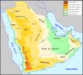
 Empty quarter Arabia.PNG 990 × 651; 345 KB
-
 Empty quarter Arabic.png 328 × 352; 51 KB
-
 Empty quarter german.png 328 × 352; 26 KB
-
 Ersian Gulf Arab States armenian.png 623 × 599; 83 KB
-
 General Map of Central Asia- II WDL11775.png 1,403 × 1,024; 2.37 MB
-
 General Map of Central Asia- Schematic View WDL11786.png 1,255 × 1,024; 2.09 MB
-
 Golf Persic - Idrocarburs.png 635 × 711; 125 KB
-
 IMCMEX 2012 areas of operations OpenStreetMap.png 1,206 × 877; 241 KB
-
-
 James Silk Buckingham's General Map of Persia.jpg 3,000 × 2,135; 1.16 MB
-
 Karte Arabische Halbinsel.png 2,104 × 1,875; 253 KB
-
 LocationMap mod.jpg 595 × 547; 74 KB
-
 Map of Jabrid Emirate (3).png 2,160 × 1,216; 258 KB
-
 Map-crop-1.png 1,214 × 1,214; 103 KB
-
 Map-crop-11.png 1,214 × 659; 88 KB
-
 Map-crop-2.png 1,500 × 1,500; 118 KB
-
 Outline map of GCC countries.png 466 × 394; 31 KB
-
 Peninsula Aràbia - Clima segon la classificacion de Köppen.png 2,911 × 2,653; 410 KB
-
 Peninsula Aràbia - Religions.png 2,911 × 2,653; 608 KB
-
 Peninsula Aràbia - Topografia.png 2,913 × 2,654; 967 KB
-
 Peninsular Arabic.svg 501 × 519; 301 KB
-
 Persian Gulf States Defined Arias .png 1,202 × 1,156; 52 KB
-
 Range map of the Socotra Buzzard.png 1,080 × 1,158; 74 KB
-
 Rub-al-Ĥalo.png 328 × 352; 31 KB
-
 Saudi Arabia transport map.jpg 1,010 × 1,194; 936 KB
-
 Semitic-map-urdu.png 1,255 × 2,000; 990 KB
-
 The Eastern Question in Europe and Asia WDL11691.png 2,121 × 1,551; 4.42 MB
-
 Tihamah.png 1,514 × 1,107; 970 KB
-
 Şamar Dağları.jpg 753 × 572; 34 KB
-
 آل رشيد2.png 612 × 600; 294 KB
-
 خريطة أهم دول و سلاطين الجزيرة العربية و قبائل قبل 100سنه.jpg 1,571 × 1,606; 512 KB
-
 خريطة قبائل الجزيرة العربية لمستشرق أنجليزي قبل مئة سنة وضعها المستشرق هارولد ديكسون.jpg 1,572 × 1,761; 835 KB
-
 خريطة قبائل منطقة شبة الجزيرة العربية و اليمن.png 1,024 × 1,024; 690 KB
-
 خريطة من الأرشيف العربي القديم للمنطقة.jpg 1,024 × 947; 204 KB
-
 وادي سرحان واطلس المملكة العربية السعودية والعالم2.jpg 808 × 1,024; 118 KB
-
 وادي سرحان والشرارات بخريطة اردنية1.jpg 495 × 508; 33 KB
-
 阿拉伯半岛以及以色列和西奈.png 1,690 × 1,224; 30 KB


.svg)
.png)


.PNG)


.png)


