Category:Maps of the Alexander Archipelago
Jump to navigation
Jump to search
Media in category "Maps of the Alexander Archipelago"
The following 60 files are in this category, out of 60 total.
-
 1903 Alaska boundary dispute.png 538 × 538; 16 KB
-
 1926 Canada-Alaska 1903 boundary-map.jpg 448 × 432; 55 KB
-
 1926 Canada-Alaska 1903 boundary-map.png 429 × 418; 433 KB
-
 Alaska boundary dispute.jpg 1,184 × 1,096; 438 KB
-
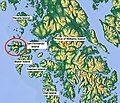
 Alaska Panhandle.png 500 × 395; 57 KB
-
 Alexander archipelago (Clarence Strait).jpg 667 × 661; 259 KB
-
 Alexander archipelago (Ernest Sound).jpg 800 × 1,067; 588 KB
-
 Alexander archipelago (Kosciusko Island).png 840 × 741; 1.2 MB
-
 Alexander archipelago (San Fernando Island).png 817 × 821; 1.32 MB
-
 Alexander archipelago (Stikine Strait).jpg 800 × 1,067; 587 KB
-
 Alexander archipelago (Sumner Strait).jpg 854 × 733; 321 KB
-
 Alexander archipelago (Zarembo Island).png 705 × 604; 926 KB
-
 Bokan mountain locator USGS.JPG 631 × 794; 81 KB
-
 Chatham Strait Mappa.jpg 800 × 1,067; 588 KB
-
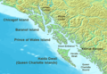
 Cleveland Peninsula.png 506 × 612; 622 KB
-
 Cordova1..PNG 689 × 455; 718 KB
-
 Coronation Island Mappa.png 1,014 × 590; 423 KB
-
 FMIB 38787 Sketch of Yes Bay Stream and Lake.jpeg 1,011 × 1,091; 103 KB
-
 Gravina island.png 500 × 400; 23 KB
-
 Gulf of Esquibel Mappa.png 613 × 547; 560 KB
-
 Heceta Island.png 805 × 627; 929 KB
-
 Iphigenia Bay Mappa.png 877 × 673; 456 KB
-
 Juneau geo south.png 920 × 805; 1.92 MB
-
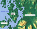
 Kanagunut Island.png 751 × 660; 773 KB
-
 Karheen Passage Mappa.png 646 × 564; 523 KB
-
 Klawock Inlet Mappa.png 689 × 593; 888 KB
-
 Klawock Map.png 555 × 643; 803 KB
-
 Kuiu Island.png 1,187 × 786; 1.7 MB
-
 Kupreanof Island.png 989 × 780; 1.57 MB
-
 Lulu Island Mappa.jpg 747 × 649; 219 KB
-
 Mappa del canale di Pearse.png 752 × 583; 919 KB
-
 Mappa dell'isola di Fillmore.png 752 × 583; 870 KB
-
 Mappa della penisola Ridge.png 752 × 583; 874 KB
-
 Mappa Kasaan Bay.png 951 × 679; 1.18 MB
-
 Mappa Skowl Arm.png 766 × 686; 821 KB
-
 Mappa Twelvemile Arm.png 882 × 691; 1.46 MB
-
 Maurelle Islands mappa.png 709 × 601; 681 KB
-
 Mitkof Island.png 926 × 726; 1.38 MB
-
 Murder Cove.png 562 × 773; 981 KB
-
 Murder Cove2.png 646 × 756; 702 KB
-
 Noyes Island Mappa.jpg 733 × 632; 260 KB
-
 NWCoast1a.png 761 × 529; 172 KB
-
 Orr Island Mappa.png 704 × 530; 720 KB
-
 Port Real Marina Mappa.png 589 × 583; 545 KB
-
 Portillo Channel Mappa.png 691 × 541; 621 KB
-
 Saint Nicholas Channel.jpg 668 × 568; 165 KB
-
 San Alberto Bay Mappa.png 628 × 608; 737 KB
-
 San Juan Bautista Island (Mappa).png 742 × 616; 902 KB
-
 Sea Otter Sound Mappa.png 867 × 504; 757 KB
-
 Sitklan Island.png 706 × 595; 474 KB
-
 The Alaska frontier (1903) (14777246084).jpg 1,938 × 2,860; 1.2 MB
-
 Tonowek Bay Mappa.png 661 × 559; 704 KB
-
 Tuxekan Passage Mappa.png 674 × 520; 530 KB
-
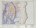 Txu-pclmaps-topo-us-ketchikan-1954 (Betton Island).jpg 1,024 × 775; 324 KB
-
 Txu-pclmaps-topo-us-ketchikan-1954 (Clover Passage).jpg 1,024 × 775; 324 KB
-
 Union Bay Mappa.png 803 × 492; 508 KB
-
 Ursua Channel (mappa).png 763 × 608; 979 KB
-
 Wadleigh Island Mappa.png 735 × 531; 757 KB
-
 Warren Channel Mappa.png 481 × 521; 197 KB
-
 Wrangell Island.png 770 × 732; 1.21 MB


.jpg)
.jpg)
.png)
.png)
.jpg)
.jpg)
.png)


.png)


_(14777246084).jpg)


.jpg)
.jpg)

.png)


