Category:Maps of the Adriatic Sea
Jump to navigation
Jump to search
Subcategories
This category has the following 3 subcategories, out of 3 total.
I
M
O
Media in category "Maps of the Adriatic Sea"
The following 116 files are in this category, out of 116 total.
-
 10 of 'Montenegro. Its people and their history. (With a map.)' (11116969555).jpg 3,430 × 2,831; 1.77 MB
-
 Admiralty Chart No 204 Porto Corsini and Otok Premuda to Porto di Trieste, Published 1966.jpg 16,382 × 11,298; 34.72 MB
-
 1988Yugoslavia map detail.gif 800 × 628; 23 KB
-
 Adria BiH.png 401 × 380; 32 KB
-
 Adria Korcula.png 401 × 380; 32 KB
-
 Adria mlj.PNG 401 × 380; 32 KB
-
 Adria zul.PNG 401 × 380; 32 KB
-
 Adriameerâ kárttá smn.svg 735 × 1,000; 223 KB
-
 Adriatic Charter.png 606 × 570; 26 KB
-
 Adriatic Coast 201 BC 3rd century (English).svg 1,600 × 1,600; 8.65 MB
-
 Adriatic Coast 201 BC 3rd century (Portuguese).svg 1,600 × 1,600; 8.64 MB
-
 Adriatic Coast 210 BC 3rd century (English).svg 1,600 × 1,600; 8.65 MB
-
 Adriatic Coast 220 BC 3rd century (English).svg 1,600 × 1,600; 8.66 MB
-
 Adriatic Coast 220 BC 3rd century (Portuguese).svg 1,600 × 1,600; 8.66 MB
-
 Adriatic Coast 226 BC 3rd century (English).svg 1,600 × 1,600; 8.66 MB
-
 Adriatic Coast 228 BC 3rd century (English).svg 1,600 × 1,600; 8.7 MB
-
 Adriatic Coast 230 BC 3rd century (English).svg 1,600 × 1,600; 8.68 MB
-
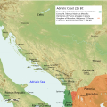
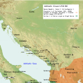
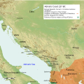 Adriatic Coast 237 BC 3rd century (English).svg 1,600 × 1,600; 8.64 MB
-
 Adriatic Coast 240 BC 3rd century (English).svg 1,600 × 1,600; 8.65 MB
-
 Adriatic Coast 250 BC 3rd century (English).svg 1,600 × 1,600; 8.67 MB
-
 Adriatic Coast 260 BC 3rd century (English).svg 1,600 × 1,600; 8.69 MB
-
 Adriatic Coast 270 BC 3rd century (English).svg 1,600 × 1,600; 8.63 MB
-
 Adriatic Coast 280 BC 3rd century (English).svg 1,600 × 1,600; 8.7 MB
-
 Adriatic Coast 290 BC 3rd century (English).svg 1,600 × 1,600; 8.72 MB
-
 Adriatic Coast 301 BC 3rd century (English).svg 1,600 × 1,600; 8.69 MB
-
 Adriatic jadran.png 1,600 × 1,209; 266 KB
-
 Adriatic Plate.jpg 817 × 783; 181 KB
-
 Adriatic Sea 02.PNG 514 × 600; 19 KB
-
 Adriatic Sea Bathymetry.svg 597 × 562; 348 KB
-
 Adriatic Sea Currents 2 (normalised).svg 350 × 900; 43 KB
-
 Adriatic Sea Currents 2.svg 900 × 350; 117 KB
-
 Adriatic sea diluvium.png 868 × 1,200; 182 KB
-
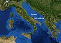
 Adriatic Sea Geographic Map.jpg 337 × 399; 129 KB
-
 Adriatic Sea in its region (IHO 1953).svg 500 × 281; 4.83 MB
-
 Adriatic Sea map ar.svg 735 × 1,000; 359 KB
-
 Adriatic Sea map fr.png 441 × 600; 34 KB
-
 Adriatic Sea map he.svg 673 × 916; 346 KB
-
 Adriatic Sea map hr.svg 673 × 916; 417 KB
-
 Adriatic Sea map hu.svg 735 × 1,000; 223 KB
-
 Adriatic Sea map mk.svg 673 × 916; 460 KB
-
 Adriatic Sea map uk.png 2,000 × 2,722; 796 KB
-
 Adriatic Sea map-es.svg 394 × 566; 1.01 MB
-
 Adriatic Sea map.png 704 × 999; 235 KB
-
 Adriatic sea pliocene (vector).svg 1,759 × 2,167; 2 MB
-
 Adriatic sea pliocene.png 1,600 × 1,952; 120 KB
-
 Adriatic Seafloor.jpg 442 × 372; 37 KB
-
 Adriatico - mito di Diomede e ritrovamenti micenei.jpeg 900 × 853; 350 KB
-
 Adriatikoa.jpg 624 × 449; 84 KB
-
 Adriatique Agathocle.jpg 2,249 × 2,999; 290 KB
-
 Area SAR IT.svg 3,713 × 3,948; 494 KB
-
 Bm adria.jpg 1,109 × 853; 391 KB
-
 Deti Adriatik harta.PNG 735 × 1,000; 210 KB
-
 Dringolf.png 844 × 660; 1,003 KB
-
 FMIB 49948 Depths of the Adriatic.jpeg 754 × 316; 48 KB
-
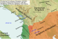 Illyria and Dardania Kingdoms (228 BC) (English).svg 1,037 × 686; 2.1 MB
-
 Illyria and Dardania Kingdoms (228 BC) (Portuguese).svg 1,037 × 686; 2.1 MB
-
 Illyria and Dardania Kingdoms (230 BC) (English).svg 1,037 × 686; 2.08 MB
-
 Illyrian Tribes (Deutsch).svg 1,600 × 1,600; 8.57 MB
-
 Illyrian Tribes (English).svg 1,600 × 1,600; 8.57 MB
-
 Illyrian Tribes (Español).svg 1,600 × 1,600; 8.57 MB
-
 Illyrian Tribes (Français).svg 1,600 × 1,600; 8.57 MB
-
 Illyrian Tribes (Italiano).svg 1,600 × 1,600; 8.57 MB
-
 Illyrian Tribes (Portuguese).svg 1,600 × 1,600; 8.57 MB
-
 Illyrian Tribes (Pусский).svg 1,600 × 1,600; 8.57 MB
-
 Illyrian Tribes (Shqipe).svg 1,600 × 1,600; 8.57 MB
-
 Illyrian Tribes (Български).svg 1,600 × 1,600; 8.57 MB
-
 Illyrian Tribes (Македонски).svg 1,600 × 1,600; 8.57 MB
-
 Illyrian Tribes (Српски-srpski).svg 1,600 × 1,600; 8.57 MB
-
 Illyrian Tribes es.svg 2,873 × 2,493; 15.64 MB
-
 Illyrians (Deutsch).svg 1,600 × 1,600; 5.11 MB
-
 Illyrians (English).svg 1,600 × 1,600; 5.11 MB
-
 Illyrians (Español).svg 1,600 × 1,600; 5.11 MB
-
 Illyrians (Français).svg 1,600 × 1,600; 5.11 MB
-
 Illyrians (Hungarian).svg 1,600 × 1,600; 5.11 MB
-
 Illyrians (Italiano).svg 1,600 × 1,600; 5.11 MB
-
 Illyrians (Portuguese).svg 1,600 × 1,600; 5.11 MB
-
 Illyrians (Pусский).svg 1,600 × 1,600; 5.11 MB
-
 Illyrians (Shqipe).svg 1,600 × 1,600; 5.11 MB
-
 Illyrians (Български).svg 1,600 × 1,600; 5.11 MB
-
 Illyrians (Македонски).svg 1,600 × 1,600; 5.11 MB
-
 Illyrians (Српски-srpski).svg 1,600 × 1,600; 5.11 MB
-
 Isole Curzolane v1.svg 1,097 × 1,062; 686 KB
-
 It-map-adriatic-sea.jpg 161 × 173; 11 KB
-
 JadranskomoreMapa.PNG 589 × 800; 121 KB
-
 Kufiri detar Shqipëri Itali.jpg 731 × 1,000; 164 KB
-
 Locatie Adriatische zee.PNG 473 × 430; 16 KB
-
 Mapa - Adriatic Sea map - Gulf of Trieste.PNG 735 × 1,000; 228 KB
-
 Mapa - Adriatic Sea map - Gulf of Venice.PNG 735 × 1,000; 228 KB
-
 Mapa de la mar Adriàtica.png 589 × 800; 76 KB
-
 Mare Adriatico.jpg 735 × 1,000; 388 KB
-
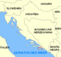
 Maritime space of Bosnia and Herzegovina.png 945 × 707; 315 KB
-
 Mediterraneo centrale 300 a.C. - epoca di Agatocle.png 1,639 × 1,072; 1.72 MB
-
 MerAdriatique.jpg 2,249 × 2,999; 290 KB
-
 Nordaadriatiko.png 1,033 × 799; 26 KB
-
 OpenSeaMap-ChartBundleArea-Adria-2016-05.png 668 × 531; 345 KB
-
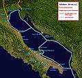
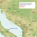
 Operational zone of the Adriatic coast.jpg 1,000 × 1,216; 275 KB
-
 Pliocen i diluvium.PNG 473 × 308; 90 KB
-
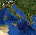
 Satellite Balkans.jpg 1,172 × 827; 742 KB
-
 Slovenija-reke-rosandra.png 382 × 668; 56 KB
-
 SoOtranto.jpg 1,155 × 1,164; 207 KB
-
 Tammar Luxoro T5 Gon.png 590 × 526; 95 KB
-
 Tribes in Illyria (English).svg 1,600 × 1,600; 5.17 MB
-
 Tribes in Illyria (Greek).svg 1,600 × 1,600; 5.18 MB
-
 Tribes in Illyria (Portuguese).svg 1,600 × 1,600; 5.17 MB
-
 Tribes in Illyria (Pусский).svg 1,600 × 1,600; 5.18 MB
-
 Venedig mit territorien.png 1,196 × 849; 221 KB
-
 VenetianRepublic 1790 EN 75dpi.png 3,172 × 1,784; 1.96 MB
-
 Venezianische Kolonien.png 1,189 × 843; 161 KB
-
 Venise et ses territoires.png 1,196 × 849; 211 KB
-
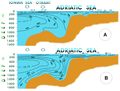
 Wind patterns in Adriatic Sea.png 725 × 644; 511 KB
-
 Yadeliyahai-ditu-zh.png 735 × 1,000; 252 KB
-
 ZERP (Adriatic sea map).png 759 × 606; 227 KB
-
 ZERP.jpg 504 × 526; 69 KB
-
 Адриатическо море.png 630 × 606; 145 KB
-
 Адриатическое море 1.png 634 × 609; 153 KB
-
 एड्रियाटिक सागर.png 735 × 1,000; 177 KB
%27_(11116969555).jpg)


.svg)
.svg)
.svg)
.svg)
.svg)
.svg)
.svg)
.svg)
.svg)
.svg)
.svg)
.svg)
.svg)
.svg)
.svg)
.svg)


.svg)


.svg)


_(English).svg)
_(Portuguese).svg)
_(English).svg)
.svg)
.svg)
.svg)
.svg)
.svg)
.svg)
.svg)
.svg)
.svg)
.svg)
.svg)

.svg)
.svg)
.svg)
.svg)
.svg)
.svg)
.svg)
.svg)
.svg)
.svg)
.svg)
.svg)


.svg)
.svg)
.svg)
.svg)


.png)


.svg)