Category:Maps of temporarily occupied territories of Ukraine
Jump to navigation
Jump to search
Media in category "Maps of temporarily occupied territories of Ukraine"
The following 11 files are in this category, out of 11 total.
-
 2014 Russo-ukrainian-conflict map.svg 4,126 × 4,480; 2.75 MB
-
 Russian occupation of North Ukraine.png 371 × 289; 56 KB
-
 Russian Occupation of Zhytomyr Oblast.png 800 × 1,037; 149 KB
-
 Russian occupied Chernihiv Oblast (2022).jpg 385 × 433; 24 KB
-
 Russian occupied Kyiv Oblast (2022).jpg 400 × 400; 18 KB
-
 Russian occupied Zhytomyr Oblast (2022).jpg 357 × 486; 25 KB
-
 Skirmishes near hadiach.png 1,180 × 714; 177 KB
-
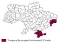 Temporarily occupied territories of Ukraine.png 569 × 460; 37 KB
-
 Ukraine under russian occupation.svg 3,780 × 2,540; 1.85 MB
-
 Временно оккупованная территория Украины.png 569 × 460; 30 KB
-
 Тимчасово окупована територія України.png 569 × 460; 37 KB


.jpg)
.jpg)
.jpg)


