Category:Maps of submarine cables
Jump to navigation
Jump to search
Subcategories
This category has only the following subcategory.
M
Media in category "Maps of submarine cables"
The following 17 files are in this category, out of 17 total.
-
 75967 South-China-Sea-1.jpg 9,570 × 6,660; 30.8 MB
-
 75967 South-China-Sea-1.pdf 1,754 × 1,239; 3.71 MB
-
 Azerbaijan and Georgia export electricity to Southeast Europe.png 3,439 × 2,638; 797 KB
-
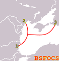 BSFOCS-Cable-route.png 342 × 351; 12 KB
-
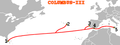
 COLUMBUS-II-route.png 469 × 160; 13 KB
-
 COLUMBUS-III-route.png 428 × 160; 10 KB
-

-
 EuroAsia Interconnector map-he.svg 900 × 427; 1.28 MB
-
 FMIB 50005 Telegraphic Cable at the Bottom of the Ocean.jpeg 701 × 570; 129 KB
-
 HE3.png 360 × 240; 19 KB
-
 HVDC Europe annotated-2019.svg 1,755 × 1,523; 427 KB
-
 LEG1 Path.png 747 × 812; 650 KB
-
 LEG1 Small gap .png 217 × 237; 102 KB
-
 RIOJA-3-map.png 180 × 186; 10 KB
-
 TWA-Cables.jpg 10,504 × 7,504; 8.63 MB
-
 世界の大陸間光海底ファイバケーブル.jpg 890 × 498; 61 KB
-
 臺澎161kV海纜示意圖.png 720 × 294; 135 KB


