Category:Maps of structural basins
Jump to navigation
Jump to search
English: Structural basins maps
· Français : Cartes des bassin structurals
· Italiano: Carte di bacini strutturali
· - Put maps of drainage basins and sedimentary basins in their relative categories
Media in category "Maps of structural basins"
The following 31 files are in this category, out of 31 total.
-
 BAB of the World -Converted-.jpg 2,279 × 1,395; 462 KB
-
 Geologic Map for the Anadarko Basin.png 1,013 × 795; 194 KB
-
 Araripe Basin map - formations and resources.jpg 1,546 × 734; 483 KB
-
 BigHornBasinStructuralMap.png 1,009 × 765; 496 KB
-
 Wpdms nasa topo bighorn basin.jpg 335 × 280; 30 KB
-
 Bighorn Basin.png 925 × 745; 1.31 MB
-
 Structural Map of the Columbus Basin, Trinidad.JPG 652 × 597; 67 KB
-
 Delaware Basin map.PNG 1,160 × 734; 123 KB
-
 Denver Basin Location Map.png 750 × 1,225; 30 KB
-
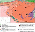
 East Texas Basin geologic map.png 571 × 595; 84 KB
-
 Geoviden-1-2011-Nordsøens-geologi.png 1,024 × 880; 212 KB
-
 Geological-summary-map-Barito Basin.jpg 529 × 750; 117 KB
-
 Maracaibo Basin.png 652 × 555; 545 KB
-
 EIA Neuquen Basin.png 863 × 888; 953 KB
-
 Powder-River-Map.jpg 412 × 444; 130 KB
-
 Riogranderift localitymap.png 595 × 704; 58 KB
-
 SanJuanBasinUSGS.jpg 728 × 601; 160 KB
-
 San Juan Basin Base Map.pdf 1,412 × 1,462; 86 KB
-
 Sibolga-basin.jpg 410 × 1,333; 121 KB
-
 South Central US Sedimentary Basins.tif 2,657 × 3,106; 32.04 MB
-
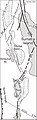
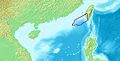 TaixinanPendi.JPG 540 × 276; 29 KB
-
 Map and Cross Section of Taranaki Basin.jpg 500 × 791; 44 KB
-
 Tremp Formation - units in the Tremp-Graus Basin.jpg 1,741 × 1,616; 1.3 MB
-
 Tularosa-Basin-NM-USGS-map opaque.gif 624 × 836; 59 KB
-
 Tularosa-Basin-NM-USGS-map.gif 624 × 836; 61 KB
-
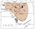
 Arches and Basins of the North Slope.jpg 1,978 × 1,324; 742 KB
-
 USGS ANS OilProductionMap.jpg 1,563 × 1,042; 224 KB
-
 West Netherlands Basin map.svg 392 × 350; 1.51 MB
-
 Williston Basin structure map.jpg 871 × 708; 86 KB
-
 WindRiverBasinStructuralMap.png 1,161 × 778; 437 KB
-
 Yinggehai basin isopach.png 1,465 × 1,975; 403 KB


