Category:Maps of rivers in New Jersey
Jump to navigation
Jump to search
States of the United States: Alabama · Alaska · Arizona · Arkansas · California · Colorado · Connecticut · Delaware · Florida · Georgia · Idaho · Illinois · Indiana · Iowa · Kansas · Kentucky · Louisiana · Maine · Maryland · Massachusetts · Michigan · Minnesota · Mississippi · Missouri · Montana · Nebraska · Nevada · New Hampshire · New Jersey · New Mexico · New York · North Carolina · North Dakota · Ohio · Oklahoma · Oregon · Pennsylvania · Rhode Island · South Carolina · South Dakota · Tennessee · Texas · Utah · Vermont · Virginia · Washington · West Virginia · Wisconsin · Wyoming – Washington, D.C.
Subcategories
This category has the following 3 subcategories, out of 3 total.
Media in category "Maps of rivers in New Jersey"
The following 51 files are in this category, out of 51 total.
-
-
 Baldwins Creek.JPG 1,440 × 601; 99 KB
-
 Beaverdam Brook.JPG 1,637 × 402; 90 KB
-
 Beden Brook.JPG 1,394 × 375; 148 KB
-
 Big Timber Creek course.jpg 575 × 425; 163 KB
-
 Branch Back Brook.JPG 1,168 × 632; 86 KB
-
 Carters Brook.JPG 360 × 656; 53 KB
-
 Cat Tail Brook.JPG 793 × 705; 93 KB
-
 Cow Yard Brook.JPG 1,228 × 508; 121 KB
-
 Cruser Brook.JPG 1,393 × 485; 86 KB
-
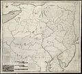
 Delaware river chart 1655.jpeg 3,329 × 1,408; 848 KB
-
 DelawareRiverBasin-01.png 1,578 × 1,830; 2.63 MB
-
 Delawarerivermap.png 1,000 × 1,005; 424 KB
-
 Devils Brook.JPG 1,576 × 529; 169 KB
-
 Duck Pond Run, New Jersey (map).jpg 1,342 × 653; 138 KB
-
 Great Ditch.JPG 1,517 × 640; 89 KB
-
 Harrys Brook.JPG 775 × 622; 117 KB
-
 Heathcote Brook Branch.JPG 274 × 464; 36 KB
-
 Heathcote Brook.JPG 1,363 × 715; 191 KB
-
 Honey Branch.JPG 772 × 664; 91 KB
-
 Hudsonmap.png 1,000 × 1,005; 416 KB
-
 Ireland Brook.JPG 1,561 × 429; 129 KB
-
 Lewis Brook.JPG 1,195 × 497; 69 KB
-
 Little Bear Brook.JPG 1,291 × 649; 139 KB
-
 Middlebush Brook.JPG 990 × 579; 87 KB
-
 Mile Run.JPG 598 × 671; 162 KB
-
 Millstone River North.JPG 1,029 × 688; 391 KB
-
 Millstone River South.JPG 1,214 × 707; 481 KB
-
 Nine Mile Run, New Jersey (map).jpg 220 × 473; 49 KB
-
 Oakeys Brook.JPG 1,264 × 668; 161 KB
-
 Passaicwatershedmap.png 600 × 600; 190 KB
-
 Paulinskillmap.png 400 × 400; 72 KB
-
 Peters Brook.JPG 1,088 × 576; 85 KB
-
 Pike Run, New Jersey (map).jpg 534 × 694; 87 KB
-
 Pine Tree Run.JPG 671 × 731; 77 KB
-
 Randolph Brook.JPG 500 × 700; 47 KB
-
 Roaring Brook, New Jersey (map).jpg 1,484 × 454; 83 KB
-
 Rocky Brook, New Jersey (map).jpg 1,306 × 703; 273 KB
-
 Royce Brook.JPG 1,303 × 635; 215 KB
-
 Sawmill Brook.JPG 972 × 654; 187 KB
-
 Shabakunk Creek map.png 606 × 561; 242 KB
-
 Simonson Brook.JPG 1,021 × 694; 102 KB
-
 Six Mile Run.JPG 1,590 × 748; 430 KB
-
 Stony Brook (Green Brook).JPG 841 × 701; 229 KB
-
 Stony Brook (NJ) map.jpg 1,381 × 726; 302 KB
-
 Stony Brook Branch.JPG 1,434 × 709; 87 KB
-
 Sucker Brook.JPG 622 × 710; 78 KB
-
 Ten Mile Run.JPG 292 × 406; 48 KB
-
 Timber Run.JPG 1,112 × 648; 56 KB
-
 West Branch Shabakunk Flood Hazard Areas.png 767 × 712; 471 KB
-
 Woodsville Brook.JPG 1,231 × 537; 97 KB
.jpg)


.jpg)


.jpg)


.jpg)


.jpg)


.JPG)
_map.jpg)


.jpg)