Category:Maps of regions of the Dominican Republic
Jump to navigation
Jump to search
Media in category "Maps of regions of the Dominican Republic"
The following 18 files are in this category, out of 18 total.
-

-
 Blancos en RD1.png 800 × 573; 33 KB
-
 Blancos en RD2.png 800 × 573; 33 KB
-
 CIBAO.png 794 × 570; 22 KB
-
 Cocolos in Dominican Republic.PNG 800 × 573; 28 KB
-
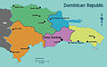 Dominican Republic Regions map.jpg 1,608 × 1,001; 401 KB
-
 ELCIBAO.png 794 × 570; 31 KB
-
 Geo Regions DR met naam.JPG 794 × 570; 80 KB
-
 Geographic Regions of the Dominican Republic.JPG 794 × 570; 64 KB
-
 Map of Geographic Regions of the Dominican Republic-2.png 1,244 × 893; 64 KB
-
 Map of Geographic Regions of the Dominican Republic.PNG 794 × 570; 33 KB
-
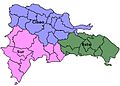
 Mapa 2-regiones-n.JPG 794 × 570; 68 KB
-
 Mapa 3-regiones-n.JPG 794 × 570; 66 KB
-
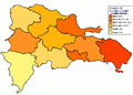
 Mapa regiones-2.jpg 794 × 570; 97 KB
-
 Non-Haitian immigrants in the DR.png 800 × 573; 28 KB
-
 Palo Hincado map.gif 264 × 227; 3 KB
-
 People of Haitian origin in the Dominican Republic.png 800 × 573; 32 KB
-
 Regiones de desarrollo de la República Dominicana.png 4,959 × 3,509; 668 KB
.jpg)


