Category:Maps of provinces of Saudi Arabia
Jump to navigation
Jump to search
Subcategories
This category has the following 3 subcategories, out of 3 total.
Media in category "Maps of provinces of Saudi Arabia"
The following 19 files are in this category, out of 19 total.
-
 Karte der Städte und Provinzen von Saudi-Arabien.png 1,483 × 1,210; 202 KB
-
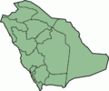 Saudi Arabia - province locator template.png 400 × 333; 12 KB
-
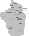
 Al Zulfi Governorate.png 680 × 845; 44 KB
-
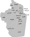
 Al-Qassim.jpg 346 × 351; 16 KB
-
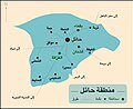 Hail 2.jpg 545 × 443; 109 KB
-
 Hail 3.jpg 545 × 443; 131 KB
-
 Provinces of Saudi Arabia.svg 500 × 415; 24 KB
-
 Riyadh governorates.png 680 × 845; 34 KB
-
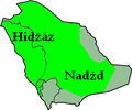 Saudi Arabia - Kingdom of hedjaz a Nejd.png 200 × 167; 9 KB
-
 Saudi Arabia provinces SVG template.svg 578 × 482; 15 KB
-
 Saudi Arabia provinces template.svg 579 × 483; 22 KB
-
 Saudi map.jpg 425 × 298; 34 KB
-
 SaudiArabiaNumbered.png 400 × 333; 11 KB
-
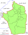
 خريطة منطقة جازان.png 715 × 455; 210 KB
-
 محافظات منطقة الرياض بالسعودية.png 680 × 845; 27 KB
-
 محافظات منطقة الرياض.png 1,324 × 1,719; 195 KB
-
 محافظات منطقة الرياض.svg 1,920 × 2,400; 122 KB
-
 محافظة السليل بالسعودية.png 488 × 371; 35 KB
-
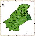
 منطقة حائل 1397 هـ.png 683 × 640; 157 KB


