Category:Maps of protected areas in California
Jump to navigation
Jump to search
States of the United States: Alabama · Alaska · Arizona · Arkansas · California · Colorado · Florida · Georgia · Hawaii · Idaho · Illinois · Indiana · Iowa · Kansas · Kentucky · Louisiana · Maine · Maryland · Massachusetts · Michigan · Minnesota · Mississippi · Missouri · Montana · Nebraska · Nevada · New Hampshire · New Jersey · New Mexico · New York · North Carolina · Ohio · Oklahoma · Oregon · Pennsylvania · South Carolina · South Dakota · Tennessee · Texas · Utah · Vermont · Virginia · Washington · West Virginia · Wisconsin · Wyoming – Washington, D.C.
American Samoa · Puerto Rico · United States Virgin Islands
American Samoa · Puerto Rico · United States Virgin Islands
Subcategories
This category has the following 18 subcategories, out of 18 total.
Media in category "Maps of protected areas in California"
The following 39 files are in this category, out of 39 total.
-

-
 Alisowoodmap-01.png 4,800 × 5,967; 2.06 MB
-
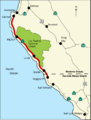 BigSurMap.png 536 × 707; 91 KB
-
 BigSurMap3.png 536 × 707; 94 KB
-
 BonnyDmap.jpg 619 × 604; 54 KB
-
 California parks1.png 473 × 437; 59 KB
-
 California parks2.png 470 × 553; 104 KB
-
 California-State-Parks-dots-only2.png 600 × 600; 44 KB
-
 Canebrake Ecological Reserve map.jpg 926 × 556; 143 KB
-
 Central California Marine Sanctuaries.jpg 479 × 658; 128 KB
-
 Channel Islands NMS map.jpg 2,000 × 1,550; 637 KB
-
 Channelislandsmap444.jpg 444 × 444; 18 KB
-
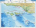
 CINMS map.jpg 2,700 × 2,100; 1 MB
-
 Cordell Bank NMS map.jpg 2,000 × 1,550; 700 KB
-
 COSCA-Open-Space-by-Name-2017-06.svg 1,530 × 990; 1.56 MB
-
 Czomap.jpg 1,380 × 879; 204 KB
-
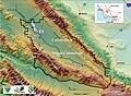 Czoreliefmap1.jpg 1,080 × 789; 152 KB
-
 DickSmithWildernessLocMap.jpg 1,583 × 1,245; 1.56 MB
-
 EldoradoNatlForestMap.png 200 × 155; 47 KB
-
 Fort-Cronkhite-Marin-Headlands-Florin-WLM-12.jpg 4,000 × 3,000; 6.02 MB
-
 Gulf of the Farallones NMS map.jpg 2,000 × 2,581; 1.13 MB
-
 Eruptions in the Lassen area in the last 50,000 years-map.jpg 335 × 378; 34 KB
-
 LocMap lassen volcanic np.png 280 × 183; 40 KB
-
 Lower Ranch Map.png 1,172 × 886; 1.6 MB
-
 Mendomap.jpg 288 × 502; 45 KB
-
 Modoc-map.png 524 × 528; 29 KB
-
 Mojave desert map-2008-15-08.jpg 300 × 250; 38 KB
-
 National Forests and National Parks in California (1907).jpg 4,248 × 5,232; 3.03 MB
-

-
 Wpdms usgs photo point reyes national seashore.jpg 300 × 300; 38 KB
-
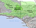
 Mulholland Corridor.jpg 1,261 × 855; 800 KB
-
 Sequoia-area-map.jpg 694 × 548; 105 KB
-
 LocMap sequoia and kings canyon np.png 280 × 183; 40 KB
-
 Sierra National Forest map.png 1,200 × 1,008; 2.15 MB
-
 Tahoeroadless.jpg 866 × 706; 200 KB
-
 The California Desert Conservation Area Plan, 1980 (1980) (20486165016).jpg 3,936 × 3,148; 1.26 MB
-
 The California Desert Conservation Area Plan, 1980 (1980) (20518719531).jpg 2,584 × 3,366; 917 KB
-
 The California Desert Conservation Area Plan, 1980 - summary (1980) (19891444813).jpg 3,601 × 3,273; 2.51 MB
-
 Upper Ranch Map.png 804 × 1,066; 1.47 MB
_(16051748723).jpg)


.jpg)


_(20486165016).jpg)
_(20518719531).jpg)
_(19891444813).jpg)
