Category:Maps of pre-Islamic Arabia
Jump to navigation
Jump to search

English: Category for maps showing the history of the Arabian Peninsula before the 6th century AD (before the time of roughly BH 123-BH 20). For later periods, there are maps starting with Category:Maps of 6th-century Arabia and onward.
Subcategories
This category has the following 5 subcategories, out of 5 total.
L
- Maps of the Lakhmid Kingdom (8 F)
M
- Maps of the Himyarite Kingdom (28 F)
- Maps of the Nabataeans (19 F)
Y
Media in category "Maps of pre-Islamic Arabia"
The following 37 files are in this category, out of 37 total.
-
 10 Afr Est -700 png élargi.png 2,001 × 1,830; 589 KB
-
 11-2 Afr Est -600 png élargi.png 2,002 × 1,830; 603 KB
-
 12-2 Afr Est -500 png élargi.png 1,998 × 1,830; 635 KB
-
 Soulier, E.; Andriveau-Goujon, J. Anciens Empires Jusqua Alexandre. 1838 (E).jpg 2,543 × 1,837; 921 KB
-
 Arabian Peninsula-565-pt.svg 341 × 348; 12 KB
-
 A Map of the Earliest Known Civilizations.jpg 2,050 × 3,042; 652 KB
-
 Aegyptus.jpg 3,234 × 2,093; 1.94 MB
-
 Arabia SPQR.png 1,600 × 1,096; 42 KB
-
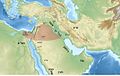
 Beyond Islam 600y Map.jpg 1,156 × 781; 162 KB
-
 Geographic Distribution of some Ancient Semitic Inscriptions and their Languages.svg 2,100 × 2,300; 744 KB
-
 HarthabinZaed.png 898 × 1,146; 1.07 MB
-
 Kindite Kingdom, ca. 500.png 1,573 × 1,270; 1.35 MB
-
 Kingdom of Axum map.png 1,242 × 1,359; 261 KB
-
 Kingdom of Kindah Map.svg 627 × 395; 155 KB
-
 Lakhmid Kingdom.png 1,802 × 1,501; 3.01 MB
-
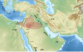
 Map of Arabia 600 AD-ar.svg 860 × 702; 1.62 MB
-
 Map of Arabia 600 AD-es.svg 2,452 × 2,000; 1.34 MB
-
 Map of Arabia 600 AD.svg 860 × 702; 1,004 KB
-
 Map of children of Abraham 2.png 576 × 872; 37 KB
-
 Map of children of Abraham.png 936 × 1,024; 69 KB
-
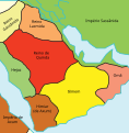
 Map of pre islamic arabia.png 936 × 1,024; 57 KB
-
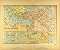 Map of the Ancient Near East.jpg 3,540 × 2,938; 2.34 MB
-
 Middle East topographic map-blank 3000bc crop.svg 1,426 × 1,083; 10.01 MB
-
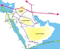 NABATAEAN TRADE ROUTES.png 886 × 727; 334 KB
-
 Near East topographic map with toponyms 3000bc-pt.svg 1,426 × 1,083; 10.04 MB
-
 Near East topographic map with toponyms 3000bc.svg 1,426 × 1,083; 10.04 MB
-
 Pre Islamic Arabia-es.svg 1,479 × 1,513; 1.41 MB
-
 Pre Islamic Arabia-pt.svg 1,479 × 1,513; 1.49 MB
-
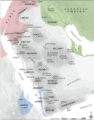
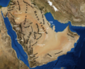
 PreIslamic Arabia-ar.png 1,524 × 2,306; 1,001 KB
-
 Qedarite kingdom 5th century.png 1,500 × 946; 2.06 MB
-
 Qedarite kingdom 5th century2.jpg 1,500 × 946; 152 KB
-
 Qedarite kingdom 5th century3.jpg 1,500 × 946; 150 KB
-
 Qedarites Map.svg 1,828 × 1,141; 10.04 MB
-
 Sabaean Kingdom.png 918 × 1,038; 24 KB
-
 Samad nlpc.jpg 3,659 × 3,156; 821 KB
-
 Tribes english.png 1,014 × 828; 1.86 MB
-
 Unknown - 2022-06-05T115124.533.png 2,622 × 1,332; 2.46 MB


.jpg)


