Category:Maps of powiats of Poland
Jump to navigation
Jump to search
Subcategories
This category has the following 4 subcategories, out of 4 total.
E
L
O
Media in category "Maps of powiats of Poland"
The following 43 files are in this category, out of 43 total.
-
 AP Leszno 3.JPG 1,000 × 1,076; 375 KB
-
 Gemeinden Polen 2020.png 2,999 × 2,669; 3.14 MB
-
 Map of Poland showing coats of arms of counties.png 2,692 × 2,542; 5.17 MB
-
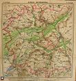
 Mapa powiatu makowskiego w Izbie Regionalnej.jpg 2,978 × 1,604; 1.85 MB
-
 Mapa powiatu szprotawskiego w Muzeum Ziemi Szprotawskiej.jpg 640 × 480; 198 KB
-
 Mazurski nazwy.PNG 525 × 407; 84 KB
-
 Nowe powiaty mazurskie.PNG 525 × 407; 83 KB
-
 Nowe powiaty mazurskie2.PNG 525 × 407; 83 KB
-
 Plcarplates379v06.png 1,600 × 1,570; 92 KB
-
 Plcarplates380v17.png 2,105 × 1,488; 307 KB
-
 Poland administrative divisions (17 voivodeships project).svg 1,000 × 930; 2.37 MB
-
 Poland administrative divisions (1998-03-19 project).svg 1,000 × 931; 2.31 MB
-
 Poland administrative divisions (1998-04-28 project).svg 1,000 × 930; 2.44 MB
-
 Poland administrative divisions (1998-06-02 project).svg 1,000 × 931; 2.3 MB
-
 Poland administrative divisions comparison map (1999 and pre-1975).svg 1,000 × 931; 1.39 MB
-
 Poland administrative divisions comparison map (1999 and pre-1999).svg 1,000 × 933; 2.26 MB
-
 Poland county map (1993-05 project).svg 1,000 × 930; 2.55 MB
-
 Poland county map (1993-08 project).svg 1,000 × 930; 2.32 MB
-
 Poland county map (1998-03 project).svg 1,000 × 931; 2.39 MB
-
 Poland county map (border changes).svg 1,000 × 930; 954 KB
-
 Poland Map Powiat 2020.png 3,589 × 3,317; 2.08 MB
-
 Poland powiaty.png 1,281 × 878; 58 KB
-
 Polish Powiats outlines.svg 820 × 775; 1.52 MB
-
 POLSKA mapa powiaty.png 1,021 × 948; 350 KB
-
 POLSKA mapa powiaty2.png 1,021 × 948; 438 KB
-
 POLSKA mapa woj z powiatami zh.png 1,021 × 948; 586 KB
-
 POLSKA mapa woj z powiatami.png 1,021 × 948; 467 KB
-
 POLSKA powiaty (województwa).svg 1,406 × 1,339; 323 KB
-
 POLSKA powiaty.svg 1,406 × 1,339; 323 KB
-
 POLSKA woj pow gminy.png 2,041 × 1,895; 1.6 MB
-
 POLSKA woj pow mod.png 1,021 × 948; 437 KB
-
 POLSKA woj pow.png 1,021 × 948; 373 KB
-
 Polska województwa powiaty.png 4,611 × 4,299; 2.79 MB
-
 Polska-adm 2015.png 19,183 × 17,837; 7.19 MB
-
 Polskie Powiaty.svg 830 × 600; 240 KB
-
 Pommern Powiat.PNG 700 × 540; 130 KB
-
 Pow katowicki 1945-50-mapa.jpg 2,470 × 1,623; 988 KB
-
 Pow.dba.tif 689 × 421; 850 KB
-
 Powiat katowicki - mapa (1933).png 2,139 × 1,359; 6.65 MB
-
 Powiat ustrzycki-mapa administracyjna 1952.png 516 × 1,000; 307 KB
-
 Powiat wadowice.png 515 × 424; 16 KB
-
 Powiats in Poland 2021.svg 799 × 756; 376 KB
-
 Powiaty i rejony.png 2,041 × 1,895; 2.29 MB


.svg)
.svg)
.svg)
.svg)
.svg)
.svg)
.svg)
.svg)
.svg)
.svg)


.svg)


.png)


