Category:Maps of political-administrative regions of Ghana
Jump to navigation
Jump to search
Subcategories
This category has the following 16 subcategories, out of 16 total.
M
- Maps of Northern Region (Ghana) (11 F)
- Maps of the Ahafo Region (2 F)
- Maps of the Ashanti Region (5 F)
- Maps of the Bono East Region (2 F)
- Maps of the Bono Region (2 F)
- Maps of the Eastern Region (Ghana) (empty)
- Maps of the Oti Region (1 F)
- Maps of the Savannah Region (3 F)
- Maps of the Volta Region (2 F)
Media in category "Maps of political-administrative regions of Ghana"
The following 31 files are in this category, out of 31 total.
-
 Ghana Ashanti.png 250 × 352; 15 KB
-
 Ghana-Brong-Ahafo.png 150 × 211; 4 KB
-
 Ghana Central.png 250 × 352; 11 KB
-
 Ghana Eastern.png 250 × 352; 10 KB
-
 Gana bölgeler.jpg 412 × 579; 31 KB
-
 Ghana Base Map.png 750 × 974; 305 KB
-
 Ghana regions blank.png 2,000 × 2,819; 34 KB
-
 Ghana regions named.png 250 × 352; 11 KB
-
 Ghana regions.png 250 × 352; 25 KB
-
 Ghana regionsspanish.PNG 250 × 352; 13 KB
-
 Ghana, administrative divisions 2018 - de - colored.svg 964 × 1,304; 437 KB
-
 Ghana-karte-politisch-ashanti.png 539 × 624; 190 KB
-
 Ghana-karte-politisch-central.png 539 × 624; 190 KB
-
 Ghana-karte-politisch-eastern.png 539 × 624; 191 KB
-
 Ghana-karte-politisch-northern.png 539 × 624; 191 KB
-
 Ghana-karte-politisch-volta.png 539 × 624; 191 KB
-
 Ghana-karte-politisch.png 539 × 624; 192 KB
-
 Ghana-Northern.png 150 × 211; 4 KB
-
 Ghana-Upper East.png 150 × 211; 4 KB
-
 Ghana-Volta.png 150 × 211; 4 KB
-
 Ghana-Western.png 150 × 211; 4 KB
-
 Jiana-diqu-zh-tw.png 241 × 349; 33 KB
-
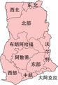 Jiana-diqu-zh.png 241 × 349; 33 KB
-
 NEW GHANA REGIONS ru.jpg 736 × 936; 69 KB
-
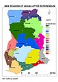 NEW GHANA REGIONS.jpg 794 × 1,123; 286 KB
-
 Regions of Ghana en.svg 484 × 653; 301 KB
-
 Regions of Ghana ru.svg 484 × 653; 301 KB
-
 Regions of Ghana.svg 484 × 653; 295 KB
-
 Ghana - Upper West.svg 964 × 1,304; 316 KB
-
 Ghana-Upper West.png 150 × 211; 4 KB
-
 Ghana Volta.png 250 × 352; 11 KB


