Category:Maps of national parks of New Zealand
Jump to navigation
Jump to search
Subcategories
This category has the following 2 subcategories, out of 2 total.
K
T
Media in category "Maps of national parks of New Zealand"
The following 16 files are in this category, out of 16 total.
-
 Map of New Zealand National Park.svg 442 × 600; 290 KB
-
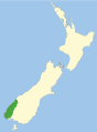
 Abel Tasman NP with arrow.svg 442 × 600; 143 KB
-
 Abel Tasman NP.svg 442 × 600; 141 KB
-
 Arthurs Pass NP.svg 442 × 600; 140 KB
-
 Egmont NP.svg 442 × 600; 140 KB
-
 Fiordland NP.svg 442 × 600; 167 KB
-
 LocMap Tongariro National Park2.png 800 × 590; 8 KB
-
 Mt Aspiring NP.svg 442 × 600; 150 KB
-
 Mt Cook NP.svg 442 × 600; 140 KB
-
 Nelson Lakes NP.svg 442 × 600; 148 KB
-
 NZ Te Wahipounamu NTNL parks.svg 442 × 600; 193 KB
-
 Paparoa NP.svg 442 × 600; 141 KB
-
 Te Urewera NP.svg 442 × 600; 155 KB
-
 Tongeriro NP.svg 442 × 600; 145 KB
-
 Westland NP.svg 442 × 600; 144 KB
-
 Whanganui NP.svg 442 × 600; 150 KB


