Category:Maps of national forests of the United States
Jump to navigation
Jump to search
Subcategories
This category has the following 27 subcategories, out of 27 total.
A
B
C
D
H
K
M
O
R
S
T
U
Media in category "Maps of national forests of the United States"
The following 85 files are in this category, out of 85 total.
-
-
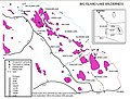 Big Island Lake Wilderness map.jpg 842 × 636; 215 KB
-
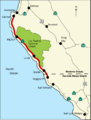 BigSurMap.png 536 × 707; 91 KB
-
 BitterrootNFMap.jpg 2,292 × 2,626; 2.47 MB
-
 Boise National Forest campgrounds map 1981.png 1,385 × 2,106; 3.4 MB
-
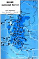
 Boise National Forest Map.jpg 5,426 × 5,625; 10.49 MB
-
 Boone National Forest Bounds 2016.png 500 × 638; 66 KB
-
 Boone-06own-map.jpg 580 × 740; 241 KB
-
 Bwca map.png 1,000 × 781; 311 KB
-
 C-ONF Map.jpg 800 × 721; 253 KB
-
 Caribbean National Forest Map.jpg 750 × 582; 36 KB
-
 Carson national forest.jpg 937 × 606; 99 KB
-
 Chippewa National Forest.png 180 × 194; 12 KB
-
 Cibola National Forest map.jpg 800 × 619; 236 KB
-
 CNF Wilderness Map.jpg 1,009 × 766; 195 KB
-
 DickSmithWildernessLocMap.jpg 1,583 × 1,245; 1.56 MB
-
 EB1911 Forests and Forestry - national forests and parks of the U.S.jpg 1,073 × 1,069; 482 KB
-
 El Yunque Trails Map.png 585 × 860; 39 KB
-
 Elements of forestry (1914) (20630710974).jpg 3,040 × 3,952; 4.55 MB
-
 Fall Creek Falls Trail Map.JPG 3,648 × 5,472; 3.44 MB
-
 Finger Lakes National Forest Map.jpg 850 × 1,400; 1.01 MB
-
 Gila NF Wilderness Map.jpg 541 × 700; 83 KB
-
 Gila-Aldo Leopold Wilderness.jpg 639 × 538; 80 KB
-
 Gmnf-map.PNG 1,072 × 1,487; 2.28 MB
-
 Gpnf vicinity.png 1,275 × 1,650; 407 KB
-
 Helena NF Map.jpg 7,466 × 5,532; 13.22 MB
-
 Huron Manistee USFS map.png 450 × 546; 18 KB
-
 Idaho panhandle forest map detail.jpg 1,400 × 2,051; 1.72 MB
-
 Idaho Panhandle NF Map.jpg 3,089 × 4,055; 5.15 MB
-
 June 12 Area Overview Map (9034703310).jpg 2,157 × 2,915; 2.35 MB
-
 Klamath National Forest Map.png 3,709 × 2,927; 6.16 MB
-
 Lolo NF Map.jpg 7,884 × 5,427; 14.47 MB
-
 Map of Shoshone National Forest.jpg 336 × 622; 61 KB
-
 MapCherokeeNF.jpeg 1,024 × 791; 238 KB
-
 Mbsweb1.png 1,136 × 1,521; 839 KB
-
 Mendomap.jpg 288 × 502; 45 KB
-
 MichiganNationalForests-zh.svg 549 × 606; 102 KB
-
 MichiganNationalForests.svg 549 × 606; 102 KB
-
 Modoc-map.png 524 × 528; 29 KB
-
 Mtnf map.jpg 579 × 589; 61 KB
-
 National Forests of US Map.gif 572 × 382; 14 KB
-
 Nez Perce National Forest Map.jpg 8,407 × 5,625; 14.13 MB
-
 Northern Minnesota Parks map.gif 806 × 823; 42 KB
-
 Oh forests.png 1,000 × 784; 1.23 MB
-
 OsceolaNF Map Florida.png 1,028 × 740; 517 KB
-
 Payette National Forest Map.jpg 9,496 × 5,625; 16.72 MB
-
 Pecos wilderness map.jpg 626 × 459; 62 KB
-

-

-
 Public-Lands-Western-US.png 818 × 567; 34 KB
-
 Rio Grande National Forest locator map.svg 278 × 278; 2.24 MB
-
 Robert E. Lee campground in Boise National Forest map.png 1,385 × 2,106; 4.04 MB
-
 SalmonChallisNFMap.jpg 2,355 × 2,729; 3.27 MB
-
 San pedro parks wilderness.jpg 646 × 768; 361 KB
-
 Santa Fe National Forest Coyote District.jpg 450 × 531; 317 KB
-
 Santa Fe National Forest Cuba District.jpg 450 × 535; 311 KB
-
 Santa Fe National Forest Pecos District.jpg 450 × 521; 312 KB
-
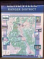
 Santa Fe National Forest Ranger Districts.jpg 450 × 399; 179 KB
-
 Sawtooth NF Map East Albers NAD83.jpg 11,008 × 10,176; 32.81 MB
-
 Sawtooth NF Map East Albers NAD83.tif 16,396 × 10,178; 35.98 MB
-
 Sawtooth NF Map North Albers NAD83.jpg 11,906 × 11,906; 34.05 MB
-
 Sawtooth NF Map North Albers NAD83.tif 12,800 × 12,800; 51.66 MB
-
 Sawtooth NF Map South Albers NAD83.jpg 13,121 × 8,142; 23.85 MB
-
 Sawtooth NF Map South Albers NAD83.tif 13,121 × 8,142; 39.78 MB
-
 Sawtooth NF Map West Albers NAD83.jpg 7,775 × 7,775; 15.09 MB
-
 Sawtooth NF Map West Albers NAD83.tif 13,117 × 8,143; 24.14 MB
-
 Shoshone wy map.jpg 2,500 × 2,036; 1.48 MB
-
 Shoshone wy map.png 2,500 × 2,036; 4.09 MB
-
 Stelprdb5209240.pdf 1,650 × 1,275; 154 KB
-

-
 Sumter National Forest (Enoree Division), South Carolina. LOC 75695937.tif 6,278 × 7,359; 132.18 MB
-
 Sumter National Forest (Long Cane Division), South Carolina. LOC 75695940.jpg 7,230 × 8,225; 8.81 MB
-
 Tahoeroadless.jpg 866 × 706; 200 KB
-
 Three Sisters Wilderness trails (south access points).jpg 409 × 750; 130 KB
-
 US-national-forest-service-lands.png 859 × 540; 110 KB
-
 USA National Forest Lands.svg 966 × 764; 78 KB
-
 USA National Forests Map.jpg 3,600 × 2,416; 1.35 MB
-
 Utah National Forest Map.gif 499 × 593; 23 KB
-
 Va nationalforests.png 830 × 650; 952 KB
-
 Washingtoncounty ut.png 980 × 663; 35 KB
-
 White Mountain National Forest.png 1,022 × 1,011; 1.95 MB
-
 White Mountain NF USFS map.jpg 1,152 × 1,056; 253 KB
-
 Willamette NF Map.gif 481 × 301; 10 KB
-
 Wpdms na-or cascadelakessb.png 588 × 491; 374 KB
-
 Wpdms na-or mcksantiampasssb.png 588 × 491; 374 KB


_(20630710974).jpg)


.jpg)


_(14597890837).jpg)


,_South_Carolina_-_1984_LOC_97683415.jpg)
,_South_Carolina._LOC_75695940.jpg)

.jpg)


