Category:Maps of municipalities of Horta Sud
Jump to navigation
Jump to search
Subcategories
This category has the following 21 subcategories, out of 21 total.
A
- Maps of Alaquàs (8 F)
- Maps of Albal (3 F)
- Maps of Alcàsser (3 F)
- Maps of Aldaia (8 F)
- Maps of Alfafar (16 F)
B
- Maps of Benetússer (8 F)
- Maps of Beniparrell (3 F)
C
- Maps of Catarroja (11 F)
L
- Maps of Llocnou de la Corona (11 F)
M
- Maps of Manises (15 F)
- Maps of Massanassa (7 F)
- Maps of Mislata (10 F)
P
- Maps of Paiporta (13 F)
- Maps of Picanya (12 F)
- Maps of Picassent (5 F)
Q
- Maps of Quart de Poblet (9 F)
S
- Maps of Sedaví (12 F)
- Maps of Silla (4 F)
T
- Maps of Torrent (Valencia) (14 F)
X
- Maps of Xirivella (10 F)
Media in category "Maps of municipalities of Horta Sud"
The following 7 files are in this category, out of 7 total.
-
 Mapa de l'Horta Sud.png 400 × 400; 44 KB
-
 Llanura aluvial de la rambla del poyo.png 884 × 450; 181 KB
-
 Picassent-Alcàsser v3.png 761 × 541; 546 KB
-
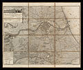
 Valencia, València -España- Área; de 1812 -1- copia.jpg 1,021 × 575; 390 KB
-
 Valencia, València -España- Área; de 1812 -1-.jpg 3,861 × 3,269; 6.28 MB
-
 València, etc-Terme 1840.png 2,760 × 2,714; 1.6 MB
-
 València, etc-Terme 1840.svg 2,761 × 2,705; 907 KB


