Category:Maps of marine parks in France
Jump to navigation
Jump to search
Media in category "Maps of marine parks in France"
The following 14 files are in this category, out of 14 total.
-
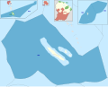
 Carte Parc naturel marin d'Iroise.png 1,894 × 1,260; 65 KB
-
 Parcs naturels français d'outre-mer.svg 2,920 × 2,347; 526 KB
-
 Parcs naturels français de métropole.svg 2,000 × 1,930; 539 KB
-
 Parcs naturels français.svg 4,920 × 2,347; 1.12 MB
-
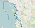
 Périmètre PNM Bassin d'Arcachon.png 1,091 × 872; 504 KB
-
 Périmètre PNM Cap Corse et Agriate.png 1,091 × 872; 384 KB
-
 Périmètre PNM des Glorieuses.png 1,091 × 872; 149 KB
-
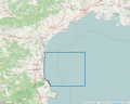
 Périmètre PNM estuaire de la Gironde et mer des Pertuis.png 1,091 × 872; 814 KB
-
 Périmètre PNM estuaires picards et mer d'Opale.png 1,091 × 872; 749 KB
-
 Périmètre PNM Golfe du Lion.png 1,091 × 872; 721 KB
-
 Périmètre PNM Iroise.png 1,091 × 872; 518 KB
-
 Périmètre PNM Martinique.png 1,199 × 799; 108 KB
-
 Périmètre PNM Mayotte.png 1,091 × 872; 98 KB
-
 Périmètre Sanctuaire Agoa.png 799 × 800; 87 KB


