Category:Maps of local municipalities of Mpumalanga
Jump to navigation
Jump to search
Media in category "Maps of local municipalities of Mpumalanga"
The following 17 files are in this category, out of 17 total.
-
 Map of Mpumalanga with Albert Luthuli highlighted (2016).svg 768 × 746; 345 KB
-
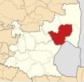
 Map of Mpumalanga with Bushbuckridge highlighted (2016).svg 768 × 746; 356 KB
-
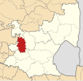
 Map of Mpumalanga with Dipaleseng highlighted (2016).svg 768 × 746; 356 KB
-
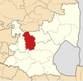
 Map of Mpumalanga with Dr JS Moroka highlighted (2016).svg 768 × 746; 343 KB
-
 Map of Mpumalanga with Emakhazeni highlighted (2016).svg 768 × 746; 346 KB
-
 Map of Mpumalanga with Emalahleni highlighted (2016).svg 768 × 746; 345 KB
-
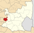
 Map of Mpumalanga with Govan Mbeki highlighted (2016).svg 768 × 746; 345 KB
-
 Map of Mpumalanga with Lekwa highlighted (2016).svg 768 × 746; 360 KB
-
 Map of Mpumalanga with Mbombela highlighted (2016).svg 768 × 746; 355 KB
-
 Map of Mpumalanga with Mkhondo highlighted (2016).svg 768 × 746; 356 KB
-
 Map of Mpumalanga with Msukaligwa highlighted (2016).svg 768 × 746; 349 KB
-
 Map of Mpumalanga with Nkomazi highlighted (2016).svg 768 × 746; 350 KB
-
 Map of Mpumalanga with Pixley ka Seme highlighted (2016).svg 768 × 746; 360 KB
-
 Map of Mpumalanga with Steve Tshwete highlighted (2016).svg 768 × 746; 350 KB
-
 Map of Mpumalanga with Thaba Chweu highlighted (2016).svg 768 × 746; 347 KB
-
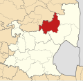
 Map of Mpumalanga with Thembisile Hani highlighted (2016).svg 768 × 746; 351 KB
-
 Map of Mpumalanga with Victor Khanye highlighted (2016).svg 768 × 746; 342 KB
.svg)
.svg)
.svg)
.svg)
.svg)
.svg)
.svg)
.svg)
.svg)
.svg)
.svg)
.svg)
.svg)
.svg)
.svg)
.svg)
.svg)