Category:Maps of local government areas in Victoria, Australia
Jump to navigation
Jump to search
Subcategories
This category has the following 3 subcategories, out of 3 total.
Media in category "Maps of local government areas in Victoria, Australia"
The following 127 files are in this category, out of 127 total.
-
 Australia-Map-VIC-LGA.png 550 × 400; 8 KB
-
 Australia Victoria Alpine Shire locator map.svg 1,375 × 967; 315 KB
-
 Australia Victoria Ararat RC.svg 1,375 × 967; 314 KB
-
 Australia Victoria Ballarat City.svg 1,375 × 967; 311 KB
-
 Australia Victoria Barwon region.svg 1,375 × 967; 323 KB
-
 Australia Victoria Barwon South West region.svg 1,375 × 967; 347 KB
-
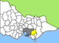
 Australia Victoria Bass Coast Shire.svg 1,375 × 967; 315 KB
-
 Australia Victoria Baw Baw Shire.svg 1,375 × 967; 318 KB
-
 Australia Victoria Benalla RC locator map.svg 1,375 × 967; 313 KB
-
 Australia Victoria Buloke Shire.svg 1,375 × 967; 314 KB
-
 Australia Victoria Campaspe Shire.svg 1,375 × 967; 315 KB
-
 Australia Victoria Cardinia Shire.svg 1,375 × 967; 313 KB
-
 Australia Victoria Central Goldfields Shire.svg 1,375 × 967; 313 KB
-
 Australia Victoria Central Highlands region.svg 1,375 × 967; 333 KB
-
 Australia Victoria Colac Otway Shire.svg 1,375 × 967; 314 KB
-
 Australia Victoria Corangamite Shire.svg 1,375 × 967; 317 KB
-
 Australia Victoria East Gippsland Shire.svg 1,375 × 967; 322 KB
-
 Australia Victoria Falls Creek Alpine Resort.svg 1,375 × 967; 311 KB
-
 Australia Victoria French Island Unincorporated Area.svg 1,375 × 967; 311 KB
-
 Australia Victoria Gannawarra Shire.svg 1,375 × 967; 313 KB
-
 Australia Victoria Gippsland region.svg 1,375 × 967; 368 KB
-
 Australia Victoria Glenelg Shire.svg 1,375 × 967; 313 KB
-
 Australia Victoria Golden Plains Shire.svg 1,375 × 967; 313 KB
-
 Australia Victoria Goulburn region.svg 1,375 × 967; 331 KB
-
 Australia Victoria Grampians region.svg 1,375 × 967; 355 KB
-
 Australia Victoria Great South Coast region.svg 1,375 × 967; 334 KB
-
 Australia Victoria Greater Bendigo City.svg 1,375 × 967; 313 KB
-
 Australia Victoria Greater Shepparton City.svg 1,375 × 967; 312 KB
-
 Australia Victoria Hepburn Shire.svg 1,375 × 967; 313 KB
-
 Australia Victoria Hindmarsh Shire.svg 1,375 × 967; 312 KB
-
 Australia Victoria Horsham RC.svg 1,375 × 967; 315 KB
-
 Australia Victoria Hume region.svg 1,375 × 967; 361 KB
-
 Australia Victoria Indigo Shire.svg 1,375 × 967; 314 KB
-
 Australia Victoria Lake Mountain Alpine Resort.svg 1,375 × 967; 311 KB
-
 Australia Victoria Latrobe City.svg 1,375 × 967; 315 KB
-
 Australia Victoria LGAs by largest council faction.svg 1,749 × 1,290; 1.14 MB
-
 Australia Victoria location map colored by type.svg 1,375 × 967; 745 KB
-
 Australia Victoria Loddon Campaspe region.svg 1,375 × 967; 334 KB
-
 Australia Victoria Loddon Mallee region.svg 1,375 × 967; 355 KB
-
 Australia Victoria Loddon Shire.svg 1,375 × 967; 315 KB
-
 Australia Victoria Macedon Ranges Shire.svg 1,375 × 967; 312 KB
-
 Australia Victoria Mallee region.svg 1,375 × 967; 331 KB
-
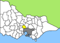
 Australia Victoria Mansfield Shire.svg 1,375 × 967; 314 KB
-
 Australia Victoria Mildura RC.svg 1,375 × 967; 316 KB
-
 Australia Victoria Mitchell Shire.svg 1,375 × 967; 315 KB
-
 Australia Victoria Moira Shire.svg 1,375 × 967; 314 KB
-
 Australia Victoria Moorabool Shire.svg 1,375 × 967; 313 KB
-
 Australia Victoria Mornington Peninsula Shire.svg 1,375 × 967; 313 KB
-
 Australia Victoria Mount Alexander Shire.svg 1,375 × 967; 312 KB
-
 Australia Victoria Mount Baw Baw Alpine Resort.svg 1,375 × 967; 311 KB
-
 Australia Victoria Mount Buller Alpine Resort.svg 1,375 × 967; 312 KB
-
 Australia Victoria Mount Hotham Alpine Resort.svg 1,375 × 967; 311 KB
-
 Australia Victoria Mount Stirling Alpine Resort.svg 1,375 × 967; 312 KB
-
 Australia Victoria Moyne Shire.svg 1,375 × 967; 315 KB
-
 Australia Victoria Murrindindi Shire.svg 1,375 × 967; 315 KB
-
 Australia Victoria Northern Grampians Shire.svg 1,375 × 967; 316 KB
-
 Australia Victoria Ovens Murray region.svg 1,375 × 967; 338 KB
-
 Australia Victoria Pyrenees Shire.svg 1,375 × 967; 315 KB
-
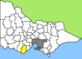
 Australia Victoria South Gippsland Shire.svg 1,375 × 967; 321 KB
-
 Australia Victoria Southern Grampians Shire.svg 1,375 × 967; 315 KB
-
 Australia Victoria Strathbogie Shire.svg 1,375 × 967; 313 KB
-
 Australia Victoria Surf Coast Shire.svg 1,375 × 967; 312 KB
-
 Australia Victoria Swan Hill RC.svg 1,375 × 967; 315 KB
-
 Australia Victoria Towong Shire.svg 1,375 × 967; 314 KB
-
 Australia Victoria Wangaratta RC.svg 1,375 × 967; 314 KB
-
 Australia Victoria Warrnambool City.svg 1,375 × 967; 311 KB
-
 Australia Victoria Wellington Shire.svg 1,375 × 967; 324 KB
-
 Australia Victoria West Wimmera Shire.svg 1,375 × 967; 313 KB
-
 Australia Victoria Wimmera Southern Mallee region.svg 1,375 × 967; 331 KB
-
 Australia Victoria Wodonga City (ringed).svg 1,375 × 967; 312 KB
-
 Australia Victoria Wodonga City.svg 1,375 × 967; 311 KB
-
 Australia Victoria Yarra Ranges Shire.svg 1,375 × 967; 316 KB
-
 Australia Victoria Yarriambiack Shire.svg 1,375 × 967; 313 KB
-
 Australia-Map-MEL-LGA-Melbourne City.png 550 × 400; 6 KB
-
 Australia-Map-MEL-LGA-Melton.png 550 × 400; 6 KB
-
 Australia-Map-VIC-LGA-Alpine.png 550 × 400; 8 KB
-
 Australia-Map-VIC-LGA-Ararat.png 550 × 400; 8 KB
-
 Australia-Map-VIC-LGA-Ballarat.png 550 × 400; 8 KB
-
 Australia-Map-VIC-LGA-Bass Coast.png 550 × 400; 8 KB
-
 Australia-Map-VIC-LGA-Baw Baw.png 550 × 400; 8 KB
-
 Australia-Map-VIC-LGA-Benalla.png 550 × 400; 8 KB
-
 Australia-Map-VIC-LGA-Buloke.png 550 × 400; 8 KB
-
 Australia-Map-VIC-LGA-Campaspe.png 550 × 400; 8 KB
-
 Australia-Map-VIC-LGA-Central Goldfields.png 550 × 400; 8 KB
-
 Australia-Map-VIC-LGA-Colac Otway.png 550 × 400; 8 KB
-
 Australia-Map-VIC-LGA-Corangamite.png 550 × 400; 8 KB
-
 Australia-Map-VIC-LGA-East Gippsland.png 550 × 400; 8 KB
-
 Australia-Map-VIC-LGA-Gannawarra.png 550 × 400; 8 KB
-
 Australia-Map-VIC-LGA-Glenelg.png 550 × 400; 8 KB
-
 Australia-Map-VIC-LGA-Golden Plains.png 550 × 400; 8 KB
-
 Australia-Map-VIC-LGA-Greater Bendigo.png 550 × 400; 8 KB
-
 Australia-Map-VIC-LGA-Greater Shepparton.png 550 × 400; 8 KB
-
 Australia-Map-VIC-LGA-Hepburn.png 550 × 400; 8 KB
-
 Australia-Map-VIC-LGA-Hindmarsh.png 550 × 400; 8 KB
-
 Australia-Map-VIC-LGA-Horsham.png 550 × 400; 8 KB
-
 Australia-Map-VIC-LGA-Indigo.png 550 × 400; 8 KB
-
 Australia-Map-VIC-LGA-Latrobe.png 550 × 400; 8 KB
-
 Australia-Map-VIC-LGA-Loddon.png 550 × 400; 11 KB
-
 Australia-Map-VIC-LGA-Macedon Ranges.png 550 × 400; 8 KB
-
 Australia-Map-VIC-LGA-Mansfield.png 550 × 400; 8 KB
-
 Australia-Map-VIC-LGA-Mildura.png 550 × 400; 8 KB
-
 Australia-Map-VIC-LGA-Mitchell.png 550 × 400; 8 KB
-
 Australia-Map-VIC-LGA-Moira.png 550 × 400; 8 KB
-
 Australia-Map-VIC-LGA-Moorabool.png 550 × 400; 8 KB
-
 Australia-Map-VIC-LGA-Mount Alexander.png 550 × 400; 8 KB
-
 Australia-Map-VIC-LGA-Moyne.png 550 × 400; 8 KB
-
 Australia-Map-VIC-LGA-Murrindindi.png 550 × 400; 8 KB
-
 Australia-Map-VIC-LGA-Northern Grampians.png 550 × 400; 8 KB
-
 Australia-Map-VIC-LGA-Pyrenees.png 550 × 400; 8 KB
-
 Australia-Map-VIC-LGA-South Gippsland.png 550 × 400; 8 KB
-
 Australia-Map-VIC-LGA-Southern Grampians.png 550 × 400; 8 KB
-
 Australia-Map-VIC-LGA-Strathbogie.png 550 × 400; 8 KB
-
 Australia-Map-VIC-LGA-Surf Coast.png 550 × 400; 8 KB
-
 Australia-Map-VIC-LGA-Swan Hill.png 550 × 400; 8 KB
-
 Australia-Map-VIC-LGA-Towong.png 550 × 400; 8 KB
-
 Australia-Map-VIC-LGA-Wangaratta.png 550 × 400; 8 KB
-
 Australia-Map-VIC-LGA-Warrnambool.png 550 × 400; 8 KB
-
 Australia-Map-VIC-LGA-Wellington.png 550 × 400; 8 KB
-
 Australia-Map-VIC-LGA-West Wimmera.png 550 × 400; 8 KB
-
 Australia-Map-VIC-LGA-Wodonga.png 550 × 400; 8 KB
-
 Australia-Map-VIC-LGA-Yarriambiack.png 550 × 400; 8 KB
-
 Shire of Rosedale map.png 3,166 × 1,759; 125 KB
-
 Vic LGA blank.png 400 × 279; 24 KB
-
 Victoria LGA types.png 800 × 1,105; 116 KB
-
 Victoria Local Government Areas.png 1,400 × 1,934; 488 KB
-
 Victoria Local Government Areas.svg 3,602 × 4,977; 331 KB
-
 Victoria old LGAs map filled.svg 811 × 581; 116 KB


.svg)


