Category:Maps of history of Christianity
Jump to navigation
Jump to search
Subcategories
This category has the following 4 subcategories, out of 4 total.
B
G
- Maps of the Great Schism (15 F)
M
- Maps of Saint Paul's journeys (67 F)
- Maps of the Western Schism (15 F)
Media in category "Maps of history of Christianity"
The following 42 files are in this category, out of 42 total.
-
 A Map of China (China's Spiritual Need and Claims, 1887).png 6,324 × 5,633; 52.7 MB
-
 A Map of China (China's Spiritual Need and Claims, 1887).xcf 6,217 × 5,569; 92.34 MB
-
 Acceptance of iconodulia after council of Nicea II.png 6,053 × 4,362; 3.44 MB
-
 Archbishopric of Ohrid in 1020, map by Dimitar Rizov (1917).jpg 1,557 × 1,608; 868 KB
-
 Arianizmus u Germánov.png 4,096 × 3,755; 1.41 MB
-
 Biskupstvá.png 10,505 × 5,961; 2.28 MB
-
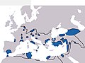
 Broad overview of geography relevant to paul of tarsus.png 1,569 × 764; 213 KB
-
 Chalkedónmapa.svg 512 × 337; 23.34 MB
-
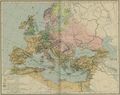
 Christian states 495 AD (en).png 2,436 × 1,372; 358 KB
-
 Christian states 495 AD (en).svg 2,436 × 1,372; 3.61 MB
-
 Christian states 495 AD (pl).svg 946 × 631; 122 KB
-
 Christian states 495 AD (ru).svg 946 × 631; 123 KB
-
 Christian states 495 AD (tr).svg 946 × 631; 122 KB
-
 Christian states 495 AD-hu.svg 946 × 631; 132 KB
-
 Christianity dev 1300.jpg 2,288 × 1,816; 675 KB
-
 Christianity in Asia.svg 512 × 319; 931 KB
-
 Christianographie - Ephraim Pagit.jpg 5,000 × 4,117; 11.06 MB
-
 Christianographie.jpg 10,380 × 7,997; 23.03 MB
-
 CNM21-Pauls3rdJourney.gif 569 × 404; 14 KB
-
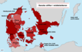 DanskeStifterMiddelalderen.png 1,803 × 1,147; 285 KB
-
 Die westliche Christenheit Mitte des 11. Jahrhunderts.png 4,520 × 2,664; 491 KB
-
 Diffusione del cristianesimo 300.jpg 2,187 × 1,619; 317 KB
-
 Distrikte der ev.-lutherischen Kirche im Königreich Ungarn (1910).jpg 1,403 × 1,487; 155 KB
-
 Empire395.png 1,995 × 1,363; 218 KB
-
 Expansion of Christianity (Smith, 1915).jpg 1,084 × 879; 1.02 MB
-
 Expansion of christianity.jpg 1,388 × 1,131; 406 KB
-
 Fifteenthannualr1901meth 0006.jpg 1,641 × 1,017; 411 KB
-
 Krist spred 1.jpg 177 × 167; 27 KB
-
 Krist spred 2.jpg 175 × 168; 29 KB
-
 Krist spred 3.jpg 226 × 168; 30 KB
-
 Krist spred 4.jpg 259 × 185; 40 KB
-
 Low Countries Medieval Dioceses-NL.png 1,664 × 2,284; 323 KB
-
 Mapachrzescijanstwa2.png 1,151 × 593; 253 KB
-
 Monasticizmus vývoj.jpg 4,120 × 3,740; 2.25 MB
-
 Monofyzitizmus.png 1,720 × 1,640; 166 KB
-
 Religionskarte für Europa im Jahre 1054..png 2,000 × 1,964; 290 KB
-
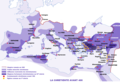
 Roman Empire with dioceses in 400 AD.png 2,042 × 1,404; 191 KB
-
 Spread of Christianity in Europe to AD 600.png 2,285 × 2,181; 249 KB
-
 Spread of Christianity to AD 600 - Atlas of World History.png 2,187 × 1,619; 227 KB
-
 VeľkáVýchodnáSchízma.png 9,709 × 7,695; 1.06 MB
-
 Voyage Paul 3.png 449 × 263; 23 KB
-
 Židia v Byzancii.jpg 1,081 × 826; 197 KB
.png)

.jpg)


.png)
.svg)
.svg)
.svg)
.svg)


.jpg)

.jpg)


