Category:Maps of gerrymandering in the United States
Jump to navigation
Jump to search
Media in category "Maps of gerrymandering in the United States"
The following 9 files are in this category, out of 9 total.
-
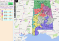 AL Gerrymander.png 877 × 610; 694 KB
-
 ColumbusOhioCongressionalDistricts.svg 1,000 × 800; 704 KB
-
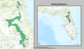 Florida US Congressional District 5 (since 2013).tif 1,738 × 1,012; 2.1 MB
-
 IL04 109.gif 687 × 379; 32 KB
-
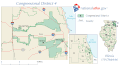
 Illinois District 4 2004.png 380 × 379; 13 KB
-
 Illinois's 17th congressional district.gif 635 × 379; 39 KB
-
 North Carolina Congressional Districts 1992-2001.svg 595 × 724; 2.34 MB
-
 Texas 30th CD 1991 - 1996.gif 366 × 480; 5 KB
-
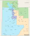 Utah Congressional Districts, 113th Congress.tif 1,350 × 1,600; 497 KB


