Category:Maps of freguesias of São Roque do Pico (Azores)
Jump to navigation
Jump to search
Media in category "Maps of freguesias of São Roque do Pico (Azores)"
The following 10 files are in this category, out of 10 total.
-
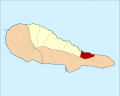
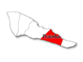
 Locator map AZO PIC Prainha.svg 886 × 709; 1,022 KB
-
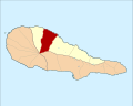
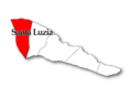
 Locator map AZO PIC Santa Luzia.svg 886 × 709; 1 MB
-
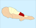
 Locator map AZO PIC Santo Amaro.svg 886 × 709; 1,019 KB
-
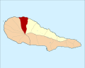
 Locator map AZO PIC Santo Antonio.svg 886 × 709; 1 MB
-
 Locator map AZO PIC Sao Roque.svg 886 × 709; 1 MB
-
 SR Pico 01.PNG 960 × 720; 68 KB
-
 SR Pico 04.PNG 960 × 720; 72 KB
-
 SR Pico 07.PNG 960 × 720; 71 KB
-
 SR Pico 10.PNG 960 × 720; 116 KB
-
 SR Pico 13.PNG 960 × 720; 122 KB


