Category:Maps of floods in India
Jump to navigation
Jump to search
Media in category "Maps of floods in India"
The following 7 files are in this category, out of 7 total.
-
 2005-Bombay-flood-map.png 300 × 559; 12 KB
-
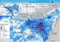 ECDM 20220525 FL India Bangladesh.pdf 2,479 × 1,754; 1.5 MB
-
 Gujarat Gulfs-fr.jpg 538 × 352; 90 KB
-
 Gujarat Gulfs.jpg 538 × 352; 25 KB
-
 India flood zone map.svg 1,639 × 1,852; 383 KB
-
 India subdivisions flood hit between July 3 and August 15 2007.png 1,024 × 1,195; 143 KB
-
 South Asia subdivisions flood hit between July 3 and August 15 2007.png 1,293 × 1,199; 66 KB


