Category:Maps of earthquakes in New Zealand
Jump to navigation
Jump to search
Subcategories
This category has the following 2 subcategories, out of 2 total.
*
Media in category "Maps of earthquakes in New Zealand"
The following 59 files are in this category, out of 59 total.
-

-
 1855 Wairarapa EQ Location1.png 673 × 884; 108 KB
-
 1929 Arthurs Pass EQ location.png 300 × 394; 9 KB
-
 1929 Murchison EQ location.png 300 × 394; 9 KB
-
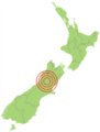
 2009 New Zealand Earthquake.jpg 417 × 610; 72 KB
-

-

-
-

-

-

-

-

-
-

-

-

-

-

-

-

-
-

-

-

-
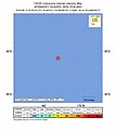
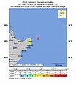
 2021-03-05 Kermadec Islands, New Zealand M8.1 earthquake shakemap (USGS).jpg 781 × 1,001; 133 KB
-
-
 2021-03-06 Gisborne, New Zealand M6.3 earthquake shakemap (USGS).jpg 786 × 995; 158 KB
-

-
-

-

-

-

-
 2021-04-05 Gisborne, New Zealand M6 earthquake shakemap (USGS).jpg 786 × 997; 155 KB
-

-
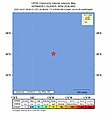
 2021-06-20 Kermadec Islands, New Zealand M6.3 earthquake shakemap (USGS).jpg 786 × 1,000; 128 KB
-

-
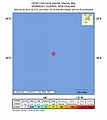
 2021-06-20 Kermadec Islands, New Zealand M6.5 earthquake shakemap (USGS).jpg 786 × 1,000; 128 KB
-
-

-

-

-
 2022-03-02 Kermadec Islands, New Zealand M6.6 earthquake shakemap (USGS).jpg 787 × 1,001; 76 KB
-

-

-
-
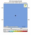
 2023-03-04 Kermadec Islands, New Zealand M6.9 earthquake shakemap (USGS).jpg 787 × 1,000; 78 KB
-

-

-
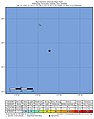
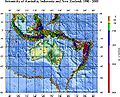 Ausseis.jpg 556 × 449; 87 KB
-
 Earthquake New Zealand Magnitude 5.8 - 2020-05-25 7.53 AM.png 814 × 793; 338 KB
-
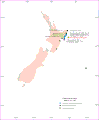
 Earthquake risk zones New Zealand.png 3,950 × 2,496; 2.41 MB
-
 Gisborne tsunami March 25th 1947.gif 1,103 × 1,341; 80 KB
-
 Gisborne tsunami May 17th 1947.gif 1,103 × 1,341; 73 KB
-
 NASA fiordland 2009 earthquake.png 720 × 480; 363 KB
-
 New Zealand earthquake 2007.png 418 × 512; 167 KB
-
 New Zealand earthquake density map.gif 479 × 484; 33 KB
-
 Survey of Earthquake Fault Trace map - Masterton Earthquake (June 24 1942) (18749413649).jpg 5,301 × 8,987; 3.77 MB
%27_(11098314714).jpg)


.jpg)
.jpg)
.jpg)
.jpg)
.jpg)
.jpg)
.jpg)
.jpg)
.jpg)
.jpg)
.jpg)
.jpg)
.jpg)
.jpg)
.jpg)
.jpg)
.jpg)
.jpg)
.jpg)
.jpg)
.jpg)
.jpg)
.jpg)
.jpg)
.jpg)
.jpg)
.jpg)
.jpg)
.jpg)
.jpg)
.jpg)
.jpg)
.jpg)
.jpg)
.jpg)
.jpg)
.jpg)
.jpg)
.jpg)
.jpg)
.jpg)
.jpg)
.jpg)
.jpg)


_(18749413649).jpg)