Category:Maps of earthquakes in Haiti
Jump to navigation
Jump to search
Subcategories
This category has the following 2 subcategories, out of 2 total.
2
- 2010 Haiti earthquake maps (18 F)
S
Media in category "Maps of earthquakes in Haiti"
The following 5 files are in this category, out of 5 total.
-
 2021-08-14 Nippes, Haiti M7.2 earthquake intensity map (USGS).jpg 612 × 684; 103 KB
-
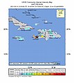
 2021-08-14 Nippes, Haiti M7.2 earthquake shakemap (USGS).jpg 787 × 971; 206 KB
-

-

-
 2021-08-14 Saint-Louis du Sud, Haiti M7.2 earthquake shakemap (USGS).jpg 787 × 976; 211 KB
.jpg)
.jpg)
.jpg)
.jpg)
.jpg)