Category:Maps of districts of Zimbabwe
Jump to navigation
Jump to search
| Upload media | |||||
| Subclass of | |||||
|---|---|---|---|---|---|
| Location |
| ||||
| |||||
Media in category "Maps of districts of Zimbabwe"
The following 31 files are in this category, out of 31 total.
-
 2008 Zimbabwe Cholera Outbreak.svg 630 × 490; 247 KB
-
 Administrative Divisions of Zimbabwe-es.svg 630 × 490; 279 KB
-
 Administrative Divisions of Zimbabwe.svg 630 × 490; 308 KB
-
 Blank Zimbabwe Map.svg 630 × 490; 237 KB
-
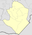
 Bulawayo district.png 1,056 × 816; 20 KB
-
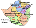
 Districts of Manicaland Province, Zimbabwe.svg 437 × 625; 1.03 MB
-
 Districts of Mashonaland Central Province, Zimbabwe.svg 750 × 625; 1.12 MB
-
 Districts of Mashonaland East Province, Zimbabwe.svg 563 × 625; 1.17 MB
-
 Districts of Mashonaland West Province, Zimbabwe.svg 563 × 625; 1.05 MB
-
 Districts of Masvingo Province, Zimbabwe.svg 563 × 625; 857 KB
-
 Districts of Matabeleland North Province, Zimbabwe.svg 625 × 625; 860 KB
-
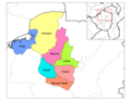
 Districts of Matabeleland South Province, Zimbabwe.svg 625 × 500; 837 KB
-
 Districts of Midlands Province, Zimbabwe.svg 437 × 625; 1.02 MB
-
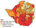 Food insecurity in Zimbabwe.svg 630 × 490; 295 KB
-
 Gweru District 2.jpg 1,200 × 910; 121 KB
-
 Harare district.png 1,056 × 816; 20 KB
-
 Kwekwe District.jpg 1,500 × 1,198; 134 KB
-
 Manicaland districts.png 1,056 × 816; 33 KB
-
 Mashonaland Central districts.png 1,056 × 816; 37 KB
-
 Mashonaland East districts.png 1,056 × 816; 39 KB
-
 Mashonaland West districts.png 1,056 × 816; 41 KB
-
 Masvingo districts.png 948 × 770; 14 KB
-
 Matabeleland North districts.png 1,056 × 816; 33 KB
-
 Matabeleland South districts.png 1,056 × 816; 37 KB
-
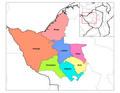
 Midlands Districts.jpg 429 × 541; 49 KB
-
 Midlands districts.png 1,056 × 816; 37 KB
-
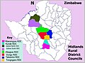 Midlands RDCs.jpg 1,224 × 918; 174 KB
-
 Zimbabwe admin.svg 630 × 490; 852 KB
-
 Zimbabwe districts.png 1,025 × 624; 21 KB
-
 Zimbabwe Municipalities.png 1,601 × 1,025; 89 KB
-
 Zimbabwe.geohive.gif 620 × 537; 37 KB


