Category:Maps of districts of South Africa
Jump to navigation
Jump to search
Subcategories
This category has the following 9 subcategories, out of 9 total.
Media in category "Maps of districts of South Africa"
The following 8 files are in this category, out of 8 total.
-
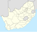
 Map of South Africa with district borders (2006).svg 809 × 709; 1.32 MB
-
 Map of South Africa with district borders (2009).svg 809 × 709; 1.32 MB
-
 Map of South Africa with district borders (2011).svg 809 × 709; 1.31 MB
-
 Map of South Africa with district borders (2016).svg 809 × 709; 651 KB
-
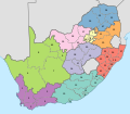
 Map of South Africa with provinces shaded and districts numbered (2009).svg 809 × 709; 1.22 MB
-

-
 Map of South Africa with provinces shaded and districts numbered (2016).svg 809 × 709; 1.19 MB
-
 South Africa Districts April 2006.png 1,141 × 828; 38 KB
.svg)
.svg)
.svg)
.svg)
.svg)
.svg)
.svg)
