Category:Maps of districts of Punjab, Pakistan
Jump to navigation
Jump to search
Provinces of Pakistan: Khyber Pakhtunkhwa · Punjab · Sindh ·
Territories: Azad Kashmir · Gilgit-Baltistan ·
Territories: Azad Kashmir · Gilgit-Baltistan ·
Subcategories
This category has the following 12 subcategories, out of 12 total.
A
- Attock District maps (3 F)
B
- Bahawalpur District maps (4 F)
C
- Chakwal District maps (13 F)
G
- Gujrat District maps (7 F)
J
- Jhelum District maps (7 F)
K
- Khanewal District maps (4 F)
N
- Nankana Sahib District maps (4 F)
P
- Pakpattan District maps (5 F)
R
- Rawalpindi District maps (9 F)
S
- Sargodha District maps (5 F)
T
- Toba Tek Singh District maps (4 F)
Media in category "Maps of districts of Punjab, Pakistan"
The following 34 files are in this category, out of 34 total.
-
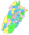
 Punjab administrative1.PNG 597 × 656; 39 KB
-
 Pakistan Punjab.png 1,000 × 740; 265 KB
-
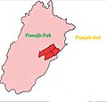
 Punjab Pakistan1.PNG 646 × 740; 146 KB
-
 Punjab Pakistan Districts.svg 979 × 1,198; 488 KB
-
 Punjab (Pakistan) Districts.svg 843 × 1,000; 67 KB
-
 Punjab administrative1.png 503 × 626; 31 KB
-
 Punjab districts.PNG 546 × 600; 142 KB
-
 Panjab-districtes.png 674 × 454; 105 KB
-
 Punjab Districts and Tehsils.PNG 503 × 626; 32 KB
-
 Punjab Districts.png 1,957 × 2,395; 166 KB
-
 Punjab Dist Names.svg 3,508 × 4,166; 639 KB
-
 Chiniotmap.JPG 1,350 × 2,020; 405 KB
-
 District Map Lodhran.jpg 1,024 × 675; 188 KB
-
 Districts of Punjab (Pakistan).png 1,400 × 1,385; 517 KB
-
 Districts of Punjab, Pakistan with district names.png 3,880 × 4,000; 2.97 MB
-
 Districts of Punjab, Pakistan.png 3,880 × 4,000; 2.64 MB
-
 Faisalabad Map Urdu.png 700 × 707; 223 KB
-
 Fsd Sadar Map.jpg 975 × 1,463; 113 KB
-
 Jaranwala Map.jpg 975 × 1,120; 106 KB
-
 Jhang District.jpg 9,845 × 11,316; 15.28 MB
-
 Jhangmap.jpg 1,800 × 1,228; 325 KB
-
 Lodhran map.gif 544 × 508; 140 KB
-
 Map faisalabad.jpg 10,407 × 11,815; 14.37 MB
-
 Map vehari.jpg 1,564 × 1,101; 626 KB
-
 Map-of-Tehsil-Hasilpur-district-bahawalpur-detail.jpg 725 × 1,116; 178 KB
-
 Map-of-Tehsil-Mailsi-District-Vehari.jpg 492 × 480; 66 KB
-
 Maptehsilpirmahal.png 2,500 × 1,378; 2.06 MB
-
 Punjab districts Pakistan.png 838 × 639; 113 KB
-
 Sahiwal breed origion.jpg 616 × 591; 42 KB
-
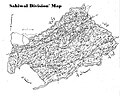 Sahiwal Division map.jpg 712 × 568; 180 KB
-
 Samundari Town.jpg 491 × 631; 90 KB
-
 Tandianwala Town.jpg 500 × 393; 79 KB
-
 Lahore-Administrative towns.png 2,811 × 1,799; 296 KB
-
 بہاولنگر ضلعے دا نہری نقشہ.jpg 2,367 × 1,638; 297 KB


_Districts.svg)


.png)


