Category:Maps of districts of Lesotho
Jump to navigation
Jump to search
Subcategories
This category has only the following subcategory.
Media in category "Maps of districts of Lesotho"
The following 17 files are in this category, out of 17 total.
-
 District of lesotho AR.PNG 1,023 × 1,000; 164 KB
-
 Districts of Lesotho.png 268 × 263; 31 KB
-
 Lesotho Base Map.png 1,108 × 694; 232 KB
-
 Lesotho Districts Berea 250px.png 250 × 251; 22 KB
-
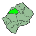
 Lesotho Districts Butha-Buthe 250px.png 250 × 251; 22 KB
-
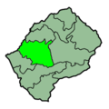
 Lesotho Districts Leribe 250px.png 250 × 251; 22 KB
-
 Lesotho Districts Mafeteng 250px.png 250 × 251; 22 KB
-
 Lesotho Districts Maseru 250px.png 250 × 251; 22 KB
-
 Lesotho Districts Mohales Hoek 250px.png 250 × 251; 22 KB
-
 Lesotho Districts Mokhotlong 250px.png 250 × 251; 22 KB
-
 Lesotho Districts Qachas Nek 250px.png 250 × 251; 22 KB
-
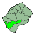
 Lesotho Districts Quthing 250px.png 250 × 251; 22 KB
-
 Lesotho Districts Thaba-Tseka 250px.png 250 × 251; 22 KB
-
 Lesotho subdivisions fr.svg 573 × 492; 402 KB
-
 Lesotho subdivisions MH.png 573 × 492; 83 KB
-
 Lesotho.geohive mk.gif 620 × 540; 13 KB
-
 Lesotho.geohive.gif 620 × 540; 10 KB


