Category:Maps of development regions of Nepal
Jump to navigation
Jump to search
Wikimedia category | |||||
| Upload media | |||||
| Instance of | |||||
|---|---|---|---|---|---|
| Category combines topics | |||||
| |||||
Subcategories
This category has only the following subcategory.
Media in category "Maps of development regions of Nepal"
The following 16 files are in this category, out of 16 total.
-
 BPY Nepal development regions.png 1,281 × 880; 85 KB
-
 Map of EaDR.png 276 × 292; 21 KB
-
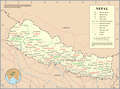
 Nepal Base Map.png 1,113 × 700; 262 KB
-
 Nepal Custom Points and offices.png 690 × 410; 256 KB
-
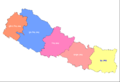
 Nepal development regions.png 1,281 × 880; 20 KB
-
 Nepal regions flood hit between July 3 and August 15 2007.png 792 × 482; 14 KB
-
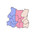
 Nepal, administrative divisions (regions) - de - colored.svg 1,200 × 714; 338 KB
-
 Nepal, administrative divisions (regions) - de - monochrome.svg 1,200 × 714; 339 KB
-
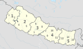
 Nepal, administrative divisions (regions) - Nmbrs - colored.svg 1,200 × 714; 338 KB
-
 Nepal, administrative divisions (regions) - Nmbrs - monochrome.svg 1,200 × 714; 339 KB
-
 Nepal, administrative divisions (regions+zones) - de - colored.svg 1,200 × 714; 338 KB
-
 Nepal, administrative divisions (regions+zones) - de - monochrome.svg 1,200 × 714; 339 KB
-
 Nepal, administrative divisions (regions+zones) - et - colored.svg 1,200 × 714; 185 KB
-
 Nepal, administrative divisions (regions+zones) - Nmbrs - colored.svg 1,200 × 714; 338 KB
-
 Nepal, administrative divisions (regions+zones) - Nmbrs - monochrome.svg 1,200 × 714; 339 KB
-
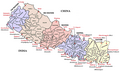
 Un-nepal.png 3,038 × 2,257; 1.56 MB


_-_de_-_colored.svg)
_-_de_-_monochrome.svg)
_-_Nmbrs_-_colored.svg)
_-_Nmbrs_-_monochrome.svg)
_-_de_-_colored.svg)
_-_de_-_monochrome.svg)
_-_et_-_colored.svg)
_-_Nmbrs_-_colored.svg)
_-_Nmbrs_-_monochrome.svg)
