Category:Maps of counties of Wyoming
Jump to navigation
Jump to search
States of the United States: Alabama · Alaska · Arizona · Arkansas · California · Colorado · Connecticut · Delaware · Florida · Georgia · Hawaii · Idaho · Illinois · Indiana · Iowa · Kansas · Kentucky · Louisiana · Maine · Maryland · Massachusetts · Michigan · Minnesota · Mississippi · Missouri · Montana · Nebraska · Nevada · New Hampshire · New Jersey · New Mexico · New York · North Carolina · North Dakota · Ohio · Oklahoma · Oregon · Pennsylvania · Rhode Island · South Carolina · South Dakota · Tennessee · Texas · Utah · Vermont · Virginia · Washington · West Virginia · Wisconsin · Wyoming
Subcategories
This category has the following 24 subcategories, out of 24 total.
*
A
- Maps of Albany County, Wyoming (11 F)
B
- Maps of Big Horn County, Wyoming (11 F)
C
F
H
J
L
- Maps of Lincoln County, Wyoming (25 F)
M
- Maps of Goshen County, Wyoming (17 F)
- Maps of Uinta County, Wyoming (16 F)
N
P
- Maps of Park County, Wyoming (4 F)
S
T
W
Media in category "Maps of counties of Wyoming"
The following 8 files are in this category, out of 8 total.
-
 Blank Map of Wyoming.svg 5,892 × 4,514; 31 KB
-
 Blank map subdivisions Wyoming.svg 128 × 106; 21 KB
-
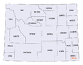
 Map Wyoming counties USA 90311.png 790 × 613; 22 KB
-
 NRHP Wyoming Map.svg 990 × 765; 7.91 MB
-
 Wyoming counties map.png 865 × 680; 48 KB
-
 Wyoming counties map.svg 5,892 × 4,514; 48 KB
-
 Wyoming county map.png 982 × 782; 15 KB
-
 Wyoming vector.svg 1,052 × 744; 24 KB


