Category:Maps of canals in Germany
Jump to navigation
Jump to search
Countries of Europe: Belgium · Czech Republic · Finland · France‡ · Germany · Greece · Italy · Netherlands‡ · Poland · Russia‡ · United Kingdom
‡: partly located in Europe
‡: partly located in Europe
Subcategories
This category has the following 5 subcategories, out of 5 total.
K
M
- Maps of the Main-Danube Canal (11 F)
- Maps of Ludwig Canal (3 F)
Media in category "Maps of canals in Germany"
The following 30 files are in this category, out of 30 total.
-
 Boker-Heide-Kanal Verlauf.svg 2,854 × 968; 51 KB
-
 Deutschland Bundeswasserstraßen.png 1,825 × 2,317; 5.52 MB
-
 Donau-Oder-Kanal.jpg 3,425 × 2,379; 3.01 MB
-

-
-
 Havelkanal.gif 1,296 × 864; 46 KB
-
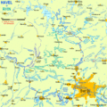 HavelRhin.gif 1,394 × 1,394; 126 KB
-
 Kanalprojekt Main Donau Michael Georg Regnet 001.jpg 800 × 901; 370 KB
-
 Karte des Datteln-Hamm-Kanals.png 2,672 × 906; 1.2 MB
-
 Karte des Rhein-Herne-Kanals.png 2,352 × 1,331; 1.4 MB
-
 Karte des Wesel-Datteln-Kanals.png 3,281 × 1,104; 1.08 MB
-
 Karte Fossa Eugeniana.png 700 × 726; 47 KB
-
 Lippe-Seitenkanal Verlauf geplant 2.png 1,056 × 248; 371 KB
-
 Lippe-Seitenkanal Verlauf geplant.png 1,058 × 595; 498 KB
-
 Karte und Höhenprofil Ludwig Kanal.jpg 1,536 × 2,075; 870 KB
-
 Map of the Kiel Canal and Eiderkanal.png 1,814 × 1,407; 3.65 MB
-
 Mittellandkanal verlauf.png 627 × 208; 11 KB
-
 Mittellandkanal.png 991 × 749; 1.13 MB
-
 Mittlere-Isar-Kanal Karte.png 1,218 × 1,062; 1.07 MB
-
 Niebuhrschleuse Karte.jpg 532 × 331; 62 KB
-
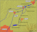
 Peene-Südkanal.png 588 × 496; 12 KB
-
 Plauer Kanal um 1900.jpg 889 × 626; 135 KB
-
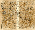
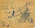
 Review of reviews and world's work (1890) (14783956702).jpg 2,188 × 1,384; 290 KB
-
 Route Intelligence Overlay E Sheet C - River Rhine - NARA - 100384843.jpg 7,340 × 5,651; 7.46 MB
-
 Route Intelligence Overlay Sheet G - River Weser - NARA - 100384841.jpg 5,800 × 7,325; 2.52 MB
-
 Route Intelligence Overlay Sheet K - Elbe Trave Canal - NARA - 100384418 (page 1).jpg 5,908 × 7,323; 2.16 MB
-
 Route Intelligence Overlay Sheet L - Elbe Trave Canal - NARA - 100384415 (page 1).jpg 7,324 × 5,817; 3.16 MB
-
 Route Intelligence Overlay Sheet L - Elbe Trave Canal - NARA - 100384415 (page 2).jpg 7,328 × 5,792; 3.1 MB
-
 Saar-Pfalz-Rhein-Kanals.PNG 382 × 496; 56 KB
-
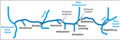
 Skizze Allerkanal.png 670 × 213; 33 KB


_(BM_1870,1112.208).jpg)
_(BM_1874,0613.2525).jpg)


_(14783956702).jpg)


.jpg)
.jpg)
.jpg)
