Category:Maps of borders of the Netherlands
Jump to navigation
Jump to search
Countries of Europe: Armenia‡ · Austria · Azerbaijan‡ · Belgium · Bulgaria · Croatia · Cyprus‡ · Denmark · Finland · France‡ · Germany · Greece · Hungary · Italy · Netherlands‡ · North Macedonia · Norway · Poland · Romania · Russia‡ · Slovakia · Slovenia · Spain‡ · Sweden · Switzerland · Turkey‡ · Ukraine · United Kingdom
‡: partly located in Europe
‡: partly located in Europe
Subcategories
This category has the following 2 subcategories, out of 2 total.
Media in category "Maps of borders of the Netherlands"
The following 35 files are in this category, out of 35 total.
-
 1867 Putte.png 1,549 × 1,352; 245 KB
-
 Baarle-Nassau - Baarle-Hertog-el.svg 1,700 × 1,700; 258 KB
-
 Baarle-Nassau - Baarle-Hertog-en.svg 1,700 × 1,700; 259 KB
-
 Baarle-Nassau - Baarle-Hertog-mk.svg 1,700 × 1,700; 312 KB
-
 Baarle-Nassau - Baarle-Hertog-nl.png 1,700 × 1,700; 444 KB
-
 Baarle-Nassau - Baarle-Hertog-nl.svg 1,700 × 1,700; 257 KB
-
 Belgium-Netherlands border changed.png 4,053 × 1,779; 5.07 MB
-
 Caribbean maritime boundaries map zh.svg 3,561 × 2,221; 2.87 MB
-
 Caribbean maritime boundaries map.svg 3,561 × 2,221; 2.78 MB
-
 Caribbean maritime boundaries map mk.svg 3,561 × 2,221; 5.52 MB
-
 Mapa das Caraíbas (fronteiras marítimas).svg 3,561 × 2,221; 2.86 MB
-
 Mapa del Caribe (límites marinos).svg 5,340 × 3,660; 3.02 MB
-
 Mapa del Mar Caribe (límites marinos)-fr.svg 3,587 × 2,221; 1.91 MB
-
 Mapa del Mar Caribe (límites marinos).svg 3,587 × 2,221; 1.98 MB
-
 Deutsch-Niederländische Grenzfrage.svg 637 × 466; 27 KB
-
 Duits-Nederlandse Grensvraag.svg 637 × 466; 202 KB
-
 Dutch Caribbean maritime boundaries with island names.svg 1,346 × 1,156; 202 KB
-
 Dutch Caribbean maritime boundaries.svg 1,346 × 1,156; 182 KB
-
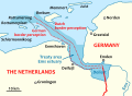 Dutch-German Border dispute.svg 637 × 466; 192 KB
-
 Duuts-Nederlaanse Grìnsvroag.svg 637 × 466; 203 KB
-
 Eben-Emael.png 719 × 726; 26 KB
-
 Germany-Netherlands border 2.jpg 1,148 × 884; 246 KB
-
 Germany-Netherlands border.jpg 647 × 809; 185 KB
-
 Koewacht 1866.gif 3,100 × 2,678; 767 KB
-
 Límites marítimos de Venezuela.png 732 × 558; 22 KB
-
 NIMBY-bos.jpg 900 × 613; 94 KB
-
 Rheiderland Emmius 1277.png 720 × 850; 1.36 MB
-
 Rheiderland Emmius 1595.png 880 × 730; 1.42 MB
-
 Spruner-Menke Handatlas 1880 Karte 39 Nebenkarte 1.jpg 1,497 × 1,864; 230 KB
-
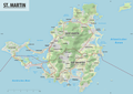 St. Martin.png 5,563 × 3,938; 6.29 MB
-
 Staatkundige kaart Groningen en Ommelanden.png 1,656 × 1,512; 791 KB
-
 Tidenems map.png 1,662 × 1,776; 1.14 MB
-
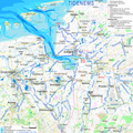 Tidenems.png 2,085 × 2,085; 2.03 MB
-
 Verdronken Dollarddorpen - Emmius, 1630.jpg 382 × 462; 87 KB
-
 Vierlandenpunt1.jpg 950 × 613; 116 KB


.svg)
.svg)
-fr.svg)
.svg)


