Category:Maps of battles of World War I
Jump to navigation
Jump to search
This is for single detailed events, for frontline overview see Category:Maps of World War I by theatre
Subcategories
This category has the following 21 subcategories, out of 21 total.
A
- Maps of the Battle of Amiens (3 F)
G
- Maps of the Battle of Gallipoli (92 F)
L
- Maps of the Battle of Liège (32 F)
- Maps of the Battle of Loos (22 F)
M
S
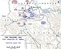
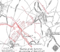
- Maps of the Battle of the Somme (94 F)
V
- Maps of the Battle of Verdun (66 F)
Y
Pages in category "Maps of battles of World War I"
This category contains only the following page.
Media in category "Maps of battles of World War I"
The following 66 files are in this category, out of 66 total.
-
 111-SC-917 - French chart - NARA - 55163163.jpg 9,182 × 6,304; 17.66 MB
-
 1915-01-12 14-Schlacht bei Soissons-01.png 845 × 661; 165 KB
-
 56th Division attack on Bouleaux Wood, Battle of Morval, 25 September 1916.png 888 × 1,074; 658 KB
-
 56th Division operations around Leuze Wood, September 1916.png 905 × 1,026; 652 KB
-
-
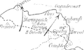
 Armentières–Bixschoote, 1914.jpg 1,123 × 776; 146 KB
-
 Mappa delle battaglie di Arras e Messines.jpg 1,600 × 1,237; 191 KB
-
 Attacks on Arras, October 1914.jpg 757 × 939; 122 KB
-
 Batailles du 4e RMZT.jpg 1,140 × 730; 206 KB
-
 Batailles du 4e RTT.jpg 1,139 × 750; 205 KB
-
 Batailles du 8e RTT.jpg 1,151 × 730; 211 KB
-
 Battle of Langemarck, from 21-24 October 1914.png 504 × 584; 242 KB
-
 Battle of Mons.jpg 1,141 × 629; 135 KB
-
 Battle of the Piave River 1918-es.svg 1,531 × 1,273; 24.67 MB
-
 Battle of the Piave River 1918.jpg 3,954 × 3,040; 785 KB
-
 Battle of Vittorio Veneto-es.svg 1,531 × 1,273; 24.77 MB
-
-
 British and French envelopment of Combles 25-26 September 1916.png 380 × 432; 91 KB
-
 British and German dispositions. Mons, 23 August 1914.jpg 1,102 × 533; 187 KB
-
 Cantigny Probable Order of Battle - NARA - 6997158 (page 1).jpg 6,336 × 5,085; 3.1 MB
-
 Cantigny, monuments américains (1918) 1.jpg 4,208 × 2,368; 3.78 MB
-
 Carte bataille du grand couronné.jpg 15,838 × 12,720; 3.13 MB
-
 Battle of Cer.jpg 1,000 × 810; 172 KB
-
 Bitwa pod Cerem-es.svg 2,496 × 2,000; 1.04 MB
-
 Delville Wood 17 July 1916 v3.png 3,111 × 2,357; 1.44 MB
-
 Diagram of Lesbœufs and vicinity evening 25 September 1916.png 1,047 × 779; 925 KB
-
 Franco-German flanking moves, 15 September - 8 October 1914.jpg 1,127 × 1,718; 446 KB
-

-
 French attacks 12 September south of Combles, Somme 1916.png 513 × 549; 127 KB
-
 French attacks after the capture of Combles, September-October 1916.png 386 × 630; 107 KB
-
 French attacks east of Combles, September-October 1916.png 386 × 630; 98 KB
-

-
 French operations Somme 1-11 July 1916.png 634 × 791; 267 KB
-
 Front-Artois-Janvier-1915-secteur Arras.jpg 3,345 × 2,230; 4.14 MB
-
 Guards Division on 15 September 1916.png 977 × 845; 741 KB
-
 Guillemont, Combles and Lesboeufs area,1916.png 719 × 955; 652 KB
-
 Initial moves, Frano-German Race to the Sea, 1914.jpg 389 × 527; 53 KB
-
 Kaniów 1918.PNG 2,299 × 2,182; 564 KB
-
 Kiauchau, 1914.jpg 958 × 640; 135 KB
-
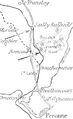
 La Bassée–vicinity of Armentières, 1914.jpg 1,121 × 688; 56 KB
-
 Lille fortress zone, 1914.jpg 822 × 828; 178 KB
-
 LstInfRgt 39 Belgien.jpg 1,089 × 765; 423 KB
-
 LstInfRgt 39 Vogesen.jpg 1,280 × 1,360; 893 KB
-
 M 99 11 carte de Suippes et la région.jpg 2,516 × 3,640; 1.77 MB
-
 M 99 12 offensive en Artois.jpg 2,466 × 3,564; 1.56 MB
-
 Map of Aubers Ridge, 1915.png 1,065 × 1,670; 1.57 MB
-
 Map of the Second Battle of Krithia 6-8 May 1915.jpg 1,200 × 823; 215 KB
-
 Map of the St. Mihiel Salient 1915.png 972 × 562; 533 KB
-
 Massacre of Dinant.png 1,772 × 2,370; 2.36 MB
-
 Maunsellp.214.jpeg 1,529 × 2,175; 1.06 MB
-
 Battle of Mount Sorrel - Battle Map - June 6 (restored1).jpg 1,741 × 2,800; 1.94 MB
-
 Battle of Mount Sorrel - Battle Map - June 6.jpg 1,741 × 2,800; 838 KB
-
 Montauban to Switch Trench through High Wood, Somme 1916.png 801 × 730; 503 KB
-
 Monte Grappa, forze in campo il 15-06-1918.jpg 1,280 × 878; 388 KB
-
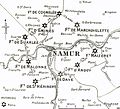 Namur fortifications, 1914.jpg 883 × 802; 173 KB
-
 NewHushmap.svg 944 × 970; 1,022 KB
-
 Operation Hush.svg 944 × 970; 1,024 KB
-
 Osowiec attack August 06 1915 map.svg 560 × 750; 64 KB
-
 Ramadi operations map 1917.jpg 3,612 × 2,170; 1.63 MB
-
 Siege and fall of Antwerp, 1914.jpg 584 × 394; 110 KB
-
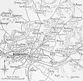
 Soissons area 1914.png 967 × 936; 677 KB
-
 Soissons area, 1914-1915.jpg 925 × 908; 187 KB
-
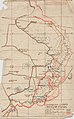
 The American Operations at Château-Thierry.jpg 3,216 × 1,876; 742 KB
-
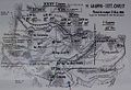
 The Battle of the Frontiers - Mulhouse and Lorraine.jpg 465 × 599; 134 KB
-
 Battle of Vittorio Veneto.jpg 1,242 × 961; 221 KB
-
 Zemljevid italijansko-avstrijskega bojišča.jpg 961 × 1,041; 218 KB


.jpg)


.jpg)
_1.jpg)


.jpg)


