Category:Maps of Xiamen
Jump to navigation
Jump to search
Wikimedia category | |||||
| Upload media | |||||
| Instance of | |||||
|---|---|---|---|---|---|
| Category combines topics | |||||
| Xiamen | |||||
prefecture-level city in Fujian, China   .svg)  | |||||
| Instance of |
| ||||
| Location | Fujian, PRC | ||||
| Legislative body | |||||
| Population |
| ||||
| Area |
| ||||
| official website | |||||
 | |||||
Subcategories
This category has the following 2 subcategories, out of 2 total.
L
- Locator maps of Xiamen (7 F)
P
Media in category "Maps of Xiamen"
The following 26 files are in this category, out of 26 total.
-

-
 Administrative Division Xiamen.png 2,320 × 2,440; 949 KB
-
 Admiralty Chart No 1029 Aimoey Harbour Entrance of Chinchew River, Published 1792.jpg 3,236 × 4,152; 2.68 MB
-

-

-
 Album of Hongkong Canton Macao Amoy Foochow 050.jpg 1,287 × 1,219; 655 KB
-
 AMH-5171-NA Map of Macao, Amy and Quemoy.jpg 2,400 × 1,694; 490 KB
-
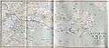
 Amoy & Kolang-soo.jpg 3,904 × 2,326; 935 KB
-
 Amoy (Xiamen) and Kinmen 1936 亞新地學社1936年《袖珍中華全圖》--14福建省厦門市.jpg 521 × 393; 105 KB
-
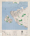 Amoy 1946 AMS.jpg 4,339 × 5,177; 5.1 MB
-
 Amoy Island.png 839 × 687; 1.08 MB
-
 ChinaFujianXiamen zh-CN.png 508 × 518; 99 KB
-
 ChinaFujianXiamen.png 508 × 518; 80 KB
-
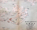
 Environs of Amoy.jpg 2,046 × 908; 253 KB
-

-
 Kulangsu International Settlement.png 1,819 × 1,613; 5.27 MB
-
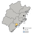
 Locator map Xiamen in Fujian.svg 780 × 818; 296 KB
-

-
 Subdivisions of Xiamen-China.png 179 × 183; 2 KB
-
 The Map of Xiamen Bus Rapid Transit (Simplified Chinese).svg 512 × 551; 234 KB
-
 Txu-oclc-10552568-ng50-15.jpg 5,000 × 3,808; 5.91 MB
-
 Xiamen China Gulangyu Island 2 by D Ramey Logan.jpg 2,858 × 2,000; 3.05 MB
-
 Xiamen-map.png 800 × 909; 334 KB
-
 Xiamen.png 960 × 1,200; 221 KB
-
 Zheng Zhilong and Koxing Map.jpg 640 × 530; 97 KB
-
 厦门海后滩全图.png 740 × 528; 281 KB
.jpg)


_and_Kinmen_1936_%E4%BA%9E%E6%96%B0%E5%9C%B0%E5%AD%B8%E7%A4%BE1936%E5%B9%B4%E3%80%8A%E8%A2%96%E7%8F%8D%E4%B8%AD%E8%8F%AF%E5%85%A8%E5%9C%96%E3%80%8B--14%E7%A6%8F%E5%BB%BA%E7%9C%81%E5%8E%A6%E9%96%80%E5%B8%82.jpg)


,_RP-P-OB-75.469.jpg)

.jpg)


.svg)