Category:Maps of West Springfield, Massachusetts
Jump to navigation
Jump to search
Media in category "Maps of West Springfield, Massachusetts"
The following 9 files are in this category, out of 9 total.
-
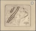
 A plan of West Springfield - (Massachusetts) LOC 2007626187.jpg 5,708 × 6,958; 4.94 MB
-
 A plan of West Springfield - (Massachusetts) LOC 2007626187.tif 5,708 × 6,958; 113.63 MB
-

-
-
 Ireland, the 3rd Parish of West Springfield, Holyoke (1827).png 3,904 × 2,597; 13.35 MB
-
 Mittineague, Mass. LOC 83693955.tif 8,933 × 5,760; 147.21 MB
-

-
 West Springfield ma highlight.png 788 × 466; 54 KB
-
 WSpringfield1795Map.png 2,085 × 3,136; 2.04 MB
_LOC_2007626187.jpg)

.jpg)
.png)


