Category:Maps of West Roxbury, Boston
Jump to navigation
Jump to search
Subcategories
This category has the following 2 subcategories, out of 2 total.
Media in category "Maps of West Roxbury, Boston"
The following 9 files are in this category, out of 9 total.
-
 1876 chart of Jamaica Pond and plan of surroundings.jpg 6,251 × 5,683; 3.83 MB
-
 1876 plan for West Roxbury Park.jpg 8,376 × 7,840; 5.97 MB
-
 1879 plan of Arnold Arboretum.jpg 4,708 × 3,732; 1.46 MB
-
 2012 District 6 Boston City Council electoral districts map.jpg 607 × 698; 570 KB
-

-
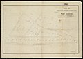 Plan of dwelling houses & house lots, in West Roxbury (2675566546).jpg 2,000 × 1,420; 2.07 MB
-
 Plan of lands in West-Roxbury, belonging to the estate of Chas. M. Taft (2675517890).jpg 2,000 × 1,566; 2.38 MB
-
 Plan of lands in West-Roxbury, belonging to the estate of Chas. M. Taft (2675518734).jpg 2,000 × 1,436; 2.12 MB
-
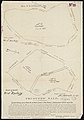 Trustees sale (2675500384).jpg 1,398 × 2,000; 1.88 MB


.jpg)
.jpg)
.jpg)
.jpg)
.jpg)