Category:Maps of West Flanders
Jump to navigation
Jump to search
Provinces of Belgium: Province of Antwerp · Brussels-Capital Region · East Flanders · Flemish Brabant · Hainaut · Province of Liege · Luxembourg · Province of Namur · Walloon Brabant · West Flanders
Use the appropriate category for maps showing all or a large part of West Flanders. See subcategories for smaller areas:
| If the map shows | Category to use |
|---|---|
| West Flanders on a recently created map | Category:Maps of West Flanders or its subcategories |
| West Flanders on a map created more than 70 years ago | Category:Old maps of West Flanders or its subcategories |
| the history of West Flanders on a recently created map | Category:Maps of the history of West Flanders or its subcategories |
| the history of West Flanders on a map created more than 70 years ago | Category:Old maps of the history of West Flanders or its subcategories |
Subcategories
This category has the following 70 subcategories, out of 70 total.
A
- Maps of Alveringem (13 F)
- Maps of Anzegem (9 F)
- Maps of Ardooie (5 F)
- Maps of Avelgem (8 F)
B
- Maps of Beernem (7 F)
- Maps of Bredene (4 F)
D
- Maps of De Haan (6 F)
- Maps of De Panne (6 F)
- Maps of Deerlijk (6 F)
- Maps of Dentergem (7 F)
G
H
- Maps of Heuvelland (11 F)
- Maps of Hooglede (5 F)
- Maps of Houthulst (9 F)
I
- Maps of Ichtegem (6 F)
- Maps of Ingelmunster (5 F)
- Maps of Izegem (7 F)
J
- Maps of Jabbeke (10 F)
K
- Maps of Knokke-Heist (11 F)
- Maps of Koekelare (6 F)
- Maps of Koksijde (6 F)
- Maps of Kortemark (7 F)
- Maps of Kuurne (4 F)
L
- Maps of Ledegem (6 F)
- Maps of Lendelede (4 F)
- Maps of Lichtervelde (8 F)
- Maps of Lo-Reninge (7 F)
M
- Maps of Mesen (4 F)
- Maps of Meulebeke (3 F)
- Maps of Middelkerke (13 F)
- Maps of Moorslede (5 F)
N
O
- Maps of Oostkamp (7 F)
- Maps of Oostrozebeke (3 F)
- Maps of Oudenburg (7 F)
P
- Maps of Pittem (5 F)
- Maps of Poperinge (14 F)
R
- Maps of Roeselare (10 F)
- Maps of Ruiselede (5 F)
S
- Maps of Spiere-Helkijn (5 F)
- Maps of Staden (8 F)
T
V
- Maps of Vleteren (6 F)
W
- Maps of Waregem (11 F)
- Maps of Wevelgem (6 F)
- Maps of Wielsbeke (7 F)
- Maps of Wingene (5 F)
Y
Z
- Maps of Zedelgem (7 F)
- Maps of Zonnebeke (8 F)
- Maps of Zuienkerke (8 F)
- Maps of Zwevegem (8 F)
Media in category "Maps of West Flanders"
The following 41 files are in this category, out of 41 total.
-
 Admiralty Chart No 1872 Dunkerque to Flushing, Published 1962, New Edition 1966.jpg 16,407 × 11,260; 26.33 MB
-
 Belgiewvl.png 398 × 335; 3 KB
-
 Belgische kuststreek in 1905.jpg 4,721 × 3,620; 6.22 MB
-
 Belgische Nordseeküste de.png 1,200 × 787; 914 KB
-
 Belgische Nordseeküste en.png 1,200 × 787; 914 KB
-
 Belgische Nordseeküste fr.png 1,200 × 787; 913 KB
-
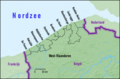 Belgische Nordseeküste nl.png 1,200 × 787; 915 KB
-
 Belgium West Flanders location map.svg 430 × 457; 99 KB
-
 BelgiumWestFlanders.png 398 × 335; 7 KB
-
 BisdomBrugge names.png 800 × 814; 212 KB
-
 Brugse Ommeland.jpg 308 × 303; 114 KB
-
 Carte Finis.png 1,082 × 843; 194 KB
-
 De Ommeloper Mestdagh nr 1016 fol. 11r uit 1693 Detail Sint-Andries.png 700 × 939; 654 KB
-
 Gemeentekaart kastelen West-Vlaanderen.png 900 × 971; 267 KB
-
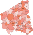
 Gemeentekaart West-Vlaanderen.svg 674 × 727; 2.02 MB
-
 Image-Judicial Arrondissement Kortrijk Belgium Map.png 188 × 201; 2 KB
-
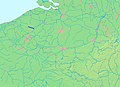 LocationRoeselareLeie.jpg 692 × 500; 440 KB
-
 Maldegemvelt.jpg 600 × 500; 150 KB
-
 Methelawoud.png 355 × 355; 50 KB
-
 Middenkust.JPG 410 × 257; 13 KB
-
 Municipalities Brugse Ommeland Belgium Map - Number.svg 674 × 727; 3.27 MB
-
 Oostkust.JPG 410 × 257; 14 KB
-
 Project stationsfotografie West-Vlaanderen (Drieskamp).svg 437 × 468; 61 KB
-
 Province di Flande Coûtchantrece (eplaeçmint).png 270 × 135; 2 KB
-
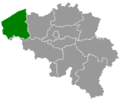
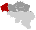
 Province of West Flanders (Belgium) location.svg 1,136 × 945; 149 KB
-
 Provincie West-Vlaanderen in Belgium.svg 1,136 × 988; 371 KB
-
 Provinz Westflandern 2019.png 1,136 × 990; 329 KB
-
 Vlaamsekust.JPG 410 × 257; 14 KB
-
 WEST VLAANDEREN MAP.png 1,082 × 843; 87 KB
-
 Westflaemische Dialekte.png 705 × 857; 55 KB
-
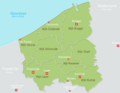
 Westhoek Belgium Map.png 270 × 203; 5 KB
-
 Westhoek map-en.svg 1,200 × 800; 714 KB
-
 Westhoek map-es.svg 1,200 × 800; 714 KB
-
 Westhoek map-fr.svg 1,200 × 800; 702 KB
-
 Westhoek map-nl.svg 1,200 × 800; 714 KB
-
 Westhoek.JPG 454 × 452; 46 KB
-
 Westhoek17.jpg 454 × 452; 80 KB
-
 Westkust.JPG 410 × 257; 13 KB
-
 WestVlaanderenbevolkingsdichtheid.PNG 635 × 401; 22 KB
-
 Westvlaanderenfinsepistes.png 270 × 216; 7 KB
-
 Zonevorming west vlaanderen.gif 924 × 1,033; 61 KB


.svg)
.png)
_location.svg)


