Category:Maps of Vorarlberg
Jump to navigation
Jump to search
Burgenland · Carinthia · Lower Austria · Salzburg · Styria · Tyrol · Upper Austria · Vienna · Vorarlberg
Wikimedia category | |||||
| Upload media | |||||
| Instance of | |||||
|---|---|---|---|---|---|
| Category combines topics | |||||
| Vorarlberg | |||||
federal state of Austria      | |||||
| Instance of | |||||
| Part of | |||||
| Location | Austria | ||||
| Visitor center |
| ||||
| Capital | |||||
| Legislative body | |||||
| Anthem |
| ||||
| Head of government |
| ||||
| Highest point | |||||
| Population |
| ||||
| Area |
| ||||
| Elevation above sea level |
| ||||
| Different from | |||||
| official website | |||||
 | |||||
Use the appropriate category for maps showing all or a large part of Vorarlberg. See subcategories for smaller areas:
| If the map shows | Category to use |
|---|---|
| Vorarlberg on a recently created map | Category:Maps of Vorarlberg or its subcategories |
| Vorarlberg on a map created more than 70 years ago | Category:Old maps of Vorarlberg or its subcategories |
| the history of Vorarlberg on a recently created map | Category:Maps of the history of Vorarlberg or its subcategories |
| the history of Vorarlberg on a map created more than 70 years ago | Category:Old maps of the history of Vorarlberg or its subcategories |
Deutsch: Karten von Vorarlberg
English: Maps of Vorarlberg
Subcategories
This category has the following 9 subcategories, out of 9 total.
Media in category "Maps of Vorarlberg"
The following 48 files are in this category, out of 48 total.
-
 Austria Vorarlberg relief location map.jpg 965 × 1,338; 468 KB
-
 Alpenrandrelief Nagelfluhschwelle.png 1,054 × 948; 2.01 MB
-

-
 Alpenrelief Bregenzerwaldgebirge und Lechquellengebirge.png 948 × 994; 1.96 MB
-
 Bistuemer oesterreich feldkirch.png 299 × 154; 12 KB
-
 Bodensee topografische Karte.jpg 12,260 × 7,290; 51.34 MB
-
 Map austria bregenz.png 299 × 154; 14 KB
-
 BregenzerAch Bodensee catchment.png 1,200 × 1,458; 2.98 MB
-
 Bregenzerwaldgebirge.png 3,366 × 3,238; 2.77 MB
-
 BudS - Vorarlberg Topo.jpg 6,950 × 9,500; 45 MB
-
 Empire d'Autriche 1914 Vorarlberg.png 3,507 × 2,480; 3.65 MB
-
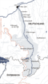
 Gemeinden im Bregenzerwald.png 270 × 255; 6 KB
-
 Grenzverlauf A-Tirol-Vorarlberg.png 2,821 × 2,954; 8.4 MB
-
 Grenzverlauf CH A.png 2,822 × 2,954; 8.4 MB
-
 Gruenzone wikipedia.jpg 3,308 × 4,675; 234 KB
-
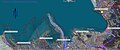
 Güterbahnhof Wolfurt Satellitenbild mit Verkehrsnetz.jpg 1,841 × 1,498; 880 KB
-
 Güterbahnhof Wolfurt.png 1,013 × 662; 1.08 MB
-
 Historische-Karte-Vorarlbergs.png 2,500 × 3,502; 1.12 MB
-
 Ill Rhein catchment.png 1,200 × 1,318; 2.91 MB
-
 Karte Allgäuer Alpen.png 3,488 × 2,013; 2.61 MB
-
 Karte Bodenseeanrainergemeinden Vorarlbergs-2.jpg 1,264 × 528; 180 KB
-
 Karte Bregenzerwald (V).png 95 × 150; 966 bytes
-
 Karte Bregenzerwald.png 290 × 150; 9 KB
-
 Karte der S-Bahn Vorarlberg.svg 693 × 881; 485 KB
-
 Karte einzugsbereich iller.png 800 × 1,397; 149 KB
-
 Karte Kleinwalsertal SRTM3.png 1,000 × 959; 1.23 MB
-
 Karte oesterreich vorarlberg.png 299 × 154; 14 KB
-
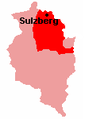 Karte Sulzberg (Bregenzerwald).png 112 × 150; 1 KB
-
 Karte Wie´n vorarlberg.png 299 × 154; 13 KB
-
 Karte Österreich Kleinwalsertal.png 299 × 154; 14 KB
-
 Karte-vorarlberg.png 400 × 600; 4 KB
-
 Lageplan Mariastern und Neu-Schönstein Hohenweiler Vbg.JPG 3,072 × 2,304; 1.66 MB
-
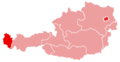
 Location of Bregenz in Vorarlberg.png 168 × 243; 4 KB
-
 Map of Spullersee.JPG 4,320 × 3,240; 8.04 MB
-
 Map Prins Friso.png 921 × 507; 433 KB
-
 Naturschutzgebiet Hohe Kugel - Hoher Freschen - Mellental.jpg 2,585 × 1,713; 1.33 MB
-
 Ravensburger Hütte, Roggalspitze, Spullersee, Wildgratspitze.jpg 819 × 495; 403 KB
-
 Swiss national map, 34 Vorarlberg.jpg 14,000 × 9,600; 156.94 MB
-
 Swisstopo Dufourkarte BLATT V. RHEINECK VERZEICHNIS LT TK 005 1850.tiff 11,666 × 8,600; 95.7 MB
-
 Swisstopo Dufourkarte BLATT X. FELDKIRCH ARLBERG LT TK 010 1853.tiff 11,680 × 8,600; 95.82 MB
-
 Vorarlberg Bezirke.png 1,400 × 2,100; 38 KB
-
 Vorarlberg Donaumonarchie.png 674 × 510; 7 KB
-
 Vorarlberg Katastralgemeinden.png 1,400 × 2,100; 68 KB
-
 Vorarlberg-Suddivisione.png 344 × 506; 54 KB
-
 Vorarlberg.png 2,057 × 1,455; 517 KB
-
 Vorderland Gemeinden ortho.jpeg 3,507 × 2,480; 1.43 MB
-
 Vorderland ortho nummerierung.jpeg 3,507 × 2,480; 1.37 MB
-
 ÖBB railjet - Passenger information system (9370592885).jpg 3,661 × 2,440; 2.95 MB


.png)


.png)


.jpg)