Category:Maps of Uzès
Jump to navigation
Jump to search
Wikimedia category | |||||
| Upload media | |||||
| Instance of | |||||
|---|---|---|---|---|---|
| Category combines topics | |||||
| Uzès | |||||
commune in Gard, France     | |||||
| Instance of | |||||
| Location |
| ||||
| Visitor center | |||||
| Head of government |
| ||||
| Population |
| ||||
| Area |
| ||||
| Elevation above sea level |
| ||||
| official website | |||||
 | |||||
Subcategories
This category has the following 2 subcategories, out of 2 total.
A
- Attraction maps of Uzès (2 F)
E
- Ecological maps of Uzès (3 F)
Media in category "Maps of Uzès"
The following 9 files are in this category, out of 9 total.
-
 30334-Uzès-argile.png 3,057 × 2,480; 5.05 MB
-
 30334-Uzès-Routes-Hydro.png 3,507 × 2,480; 3.58 MB
-
 30334-Uzès-Sols.png 3,270 × 2,598; 3.54 MB
-
 Capture d’écran 2021-12-08 à 12.08.47.png 2,636 × 2,274; 10.59 MB
-
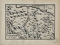
 Carte du diocèse d'Uzès.jpg 13,179 × 11,629; 87.5 MB
-
 Diocèse Uzès 1789.svg 2,000 × 1,922; 801 KB
-
 Gouvernement d'Uzez (Uzès) - btv1b10661147p.jpg 2,164 × 1,608; 573 KB
-
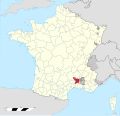
 Map commune FR insee code 30334.png 756 × 605; 85 KB
-
 Map Uzès.png 288 × 539; 115 KB


_-_btv1b10661147p.jpg)
