Category:Maps of Upper Palatinate
Jump to navigation
Jump to search
Deutsch: Karten und Pläne des Regierungsbezirks Oberpfalz
Wikimedia category | |||||
| Upload media | |||||
| Instance of | |||||
|---|---|---|---|---|---|
| Category combines topics | |||||
| Upper Palatinate | |||||
administrative region of Bavaria, Germany     | |||||
| Instance of | |||||
| Location | Bavaria, Germany | ||||
| Capital | |||||
| Head of government |
| ||||
| Highest point | |||||
| Population |
| ||||
| Area |
| ||||
| Elevation above sea level |
| ||||
| official website | |||||
 | |||||
Subcategories
This category has the following 17 subcategories, out of 17 total.
A
- Maps of Amberg (1 P, 14 F)
M
- Maps of Oberpfälzer Wald (5 F)
N
R
- Maps of Landkreis Regensburg (2 F)
S
T
W
- Maps of Weiden in der Oberpfalz (11 F)
Media in category "Maps of Upper Palatinate"
The following 39 files are in this category, out of 39 total.
-
 Bayern rboberpfalz.png 237 × 245; 20 KB
-
 Locator map Oberpfalz in Germany.svg 1,075 × 1,273; 581 KB
-
 Locator map RB Oberpfalz in Bavaria.svg 867 × 855; 1,010 KB
-
 Regierungsbezirk Oberpfalz 1970.png 773 × 797; 24 KB
-
 Palatinatus Bavariae Descriptio 1584 - Abraham Ortelius.jpg 2,207 × 1,800; 1.08 MB
-
 Oberpfalz - Palatinatus Bavariae - Johann Bussemacher 1596.jpg 2,201 × 1,647; 621 KB
-
 Palatinatus Bavariae 1602 - Abraham Ortelius bei Michel Coignet.jpg 680 × 486; 204 KB
-
 Karte - Palatinatus Bavariae - Janssonius - 1616.jpg 1,358 × 1,069; 540 KB
-
 Karte vom Nordgau Cosmographia Sebastian Muenster 1628.jpg 1,600 × 1,200; 1.1 MB
-
 Blaeu 1645 - Palatinatus Bavariæ.jpg 3,621 × 3,006; 1.44 MB
-
 Ober Bayern oder Ober Pfalz ca.1658 von Joannis Janßonius.jpg 1,233 × 1,114; 434 KB
-
 "Palatinatus Bavariae" (22245708522).jpg 3,840 × 3,009; 2.88 MB
-

-
 Territorii Novoforensis (Newenmarck) Nicolaus Rittershausen.jpg 5,500 × 4,357; 2.65 MB
-
 Bairischer Reichskreis, nördlicher Teil mit Oberpfalz.JPG 2,592 × 1,936; 1.65 MB
-
 Oberpfalz Nordgau - Johann Baptist Homann.jpg 1,276 × 1,066; 757 KB
-
 Karte - südliche Oberpfalz - um 1790.jpg 1,358 × 954; 352 KB
-
 Karte - Schlacht bei Amberg - 1796.jpg 2,253 × 1,500; 795 KB
-
 Karte - Chaussee von Ingolstadt resp Denkendorf nach Amberg - um 1835.jpg 996 × 1,500; 348 KB
-
 Oberpfalz Niederbayern 1905.png 1,530 × 2,000; 1.57 MB
-

-
 Расположение провинции Верхний Пфальц на карте Германской империи.svg 2,621 × 2,224; 511 KB
-
 Karte Jagdreviere Landkreis Cham Stand 2019.png 1,858 × 1,358; 2.28 MB
-
 Hersbrucker Alb.png 1,180 × 825; 410 KB
-
 Hersbrucker Schweiz.png 1,180 × 825; 412 KB
-
 Karte - Palatinatus Bavariae - Merian - 1644.jpg 1,352 × 902; 317 KB
-
 Karte der Gegend zwischen Cham und Winklarn, Ausschnitt Sankt Leonhard.tif 2,002 × 1,875; 13.69 MB
-
 Karte der Gegend zwischen Cham und Winklarn, Ausschnitt Schwarzenburg.tif 1,346 × 1,422; 7.13 MB
-
 Karte der Gegend zwischen Cham und Winklarn, Ausschnitt Schönthal.tif 3,284 × 2,068; 24.88 MB
-
 Karte der Gegend zwischen Cham und Winklarn, Ausschnitt Waldmünchen.tif 2,416 × 2,144; 18.76 MB
-
 Karte der Gegend zwischen Cham und Winklarn, entrastert.tif 9,184 × 7,294; 92.48 MB
-
 Karte der Gegend zwischen Cham und Winklarn.tif 9,184 × 7,294; 239.22 MB
-
 Kdbk neustadt 0195.jpg 2,551 × 2,460; 645 KB
-
 Nicolaes Visscher - Karte Oberpfalz.jpg 6,919 × 5,736; 45.1 MB
-
 Nordgau 1000.PNG 544 × 496; 193 KB
-
 Nordgau locator map (1000).svg 1,875 × 1,815; 5.74 MB
-
 Philipp Apian - Bairische Landtafeln von 1568 - Tafel 06.jpg 6,264 × 4,768; 6.35 MB
-
 Regional key map of 093 in Germany.svg 867 × 855; 1,011 KB
-
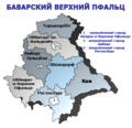 Баварский Верхний Пфальц.png 538 × 518; 46 KB


.jpg)
.jpg)
_Nicolaus_Rittershausen.jpg)


.jpg)


.svg)


