Category:Maps of Tyler County, West Virginia
Jump to navigation
Jump to search
Counties of West Virginia: Barbour · Berkeley · Boone · Braxton · Brooke · Cabell · Calhoun · Clay · Doddridge · Fayette · Gilmer · Grant · Greenbrier · Hampshire · Hancock · Hardy · Harrison · Jackson · Jefferson · Kanawha · Lewis · Lincoln · Logan · Marion · Marshall · Mason · McDowell · Mercer · Mineral · Mingo · Monongalia · Monroe · Morgan · Nicholas · Ohio · Pendleton · Pleasants · Pocahontas · Preston · Putnam · Raleigh · Randolph · Ritchie · Roane · Summers · Taylor · Tucker · Tyler · Upshur · Wayne · Webster · Wetzel · Wirt · Wood · Wyoming
Wikimedia category | |||||
| Upload media | |||||
| Instance of | |||||
|---|---|---|---|---|---|
| Category combines topics | |||||
| Tyler County | |||||
county in West Virginia, United States   | |||||
| Instance of |
| ||||
| Named after | |||||
| Location |
| ||||
| Capital | |||||
| Inception |
| ||||
| Population |
| ||||
| Area |
| ||||
| Different from | |||||
| official website | |||||
 | |||||
Subcategories
This category has the following 2 subcategories, out of 2 total.
Media in category "Maps of Tyler County, West Virginia"
The following 11 files are in this category, out of 11 total.
-
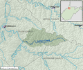
 Arnold Creek WV map.png 2,891 × 2,252; 5.9 MB
-
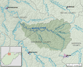
 Elk Fork (Point Pleasant Creek) map.png 2,538 × 2,383; 5.52 MB
-
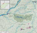
 Indian Creek (Middle Island Creek) map.png 2,572 × 2,174; 5.05 MB
-
 Map of West Virginia highlighting Tyler County.svg 4,270 × 3,810; 110 KB
-
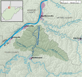
 McElroy Creek map.png 2,690 × 2,174; 5.69 MB
-
 McKim Creek WV map.png 2,684 × 2,387; 6.26 MB
-
 Middle Island Creek map.png 2,832 × 2,387; 8.26 MB
-
 Point Pleasant Creek map.png 2,538 × 2,383; 5.6 MB
-
 Sancho Creek WV map.png 2,538 × 2,387; 5.49 MB
-
 Sugar Creek (Middle Island Creek) map.png 2,685 × 2,254; 5.47 MB
-
 West Virginia Senate District 2 (2010).png 3,543 × 3,081; 787 KB

_map.png)
_map.png)


_map.png)
.png)