Category:Maps of Trinidad and Tobago
Jump to navigation
Jump to search
Countries of North America: Antigua and Barbuda · The Bahamas · Barbados · Belize · Canada · Costa Rica · Cuba · Dominica · Dominican Republic · El Salvador · Grenada · Guatemala · Haiti · Honduras · Jamaica · Mexico · Nicaragua · Panama · Saint Kitts and Nevis · Saint Lucia · Saint Vincent and the Grenadines · Trinidad and Tobago‡ · United States of America‡
Other territories: Anguilla · Bermuda · British Virgin Islands · Cayman Islands · Florida Keys · Greenland · Guadeloupe · Martinique · Montserrat · Puerto Rico · Saint Barthélemy · Saint-Martin · Saint Pierre and Miquelon · Turks and Caicos Islands · United States Virgin Islands
‡: partly located in North America
Countries of South America: Argentina · Bolivia · Brazil · Chile · Colombia · Ecuador · Guyana · Paraguay · Peru · Suriname · Trinidad and Tobago‡ · Uruguay · Venezuela
Other territories: Aruba · Bonaire · Curaçao · Falkland Islands · French Guiana · South Georgia and the South Sandwich Islands
‡: partly located in South America
Other territories: Aruba · Bonaire · Curaçao · Falkland Islands · French Guiana · South Georgia and the South Sandwich Islands
‡: partly located in South America
Wikimedia category | |||||
| Upload media | |||||
| Instance of | |||||
|---|---|---|---|---|---|
| Category combines topics | |||||
 | |||||
Subcategories
This category has the following 17 subcategories, out of 17 total.
Pages in category "Maps of Trinidad and Tobago"
The following 2 pages are in this category, out of 2 total.
Media in category "Maps of Trinidad and Tobago"
The following 27 files are in this category, out of 27 total.
-
 Admiralty Chart No 508 Ports and Anchorages in Tobago, Published 1965.jpg 16,417 × 11,272; 20.07 MB
-
 Caledonia Island.png 650 × 600; 16 KB
-
 Caroni Plain.jpg 1,750 × 1,704; 441 KB
-
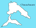 Chacachacare Map.PNG 336 × 267; 6 KB
-
 Craigsziget.png 650 × 600; 46 KB
-
 Dk bg trinidad map.png 1,024 × 1,024; 148 KB
-
 East-West Corridor.PNG 744 × 546; 18 KB
-
 ECDM 20200724 TC GONZALO.pdf 1,625 × 1,125; 854 KB
-
 ECDM 20210702 TC ELSA.pdf 1,625 × 1,125; 378 KB
-
 ECHO Caribbean Basemap A3 Landscape v2.png 4,959 × 3,509; 702 KB
-
 ECHO Trinidad and Tobago Editable A4 Landscape.pdf 1,754 × 1,239; 225 KB
-
 ECHO Trinidad and Tobago Editable A4 Landscape.png 1,123 × 794; 217 KB
-
 FLII Trinidad.png 966 × 840; 317 KB
-
 Lenagan-sziget.png 650 × 600; 44 KB
-
 PAT - Trinidad-Tobago.gif 860 × 975; 77 KB
-
 Saut d'Eau, Trinidad and Tobago Map.png 600 × 450; 109 KB
-
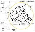 Structural Map of the Columbus Basin, Trinidad.JPG 652 × 597; 67 KB
-
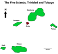
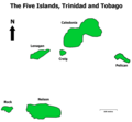 The Five Islands, Trinidad and Tobago.png 650 × 600; 104 KB
-
 Trinidad and Tobago Base Map.png 1,106 × 693; 186 KB
-
 Trinidad and Tobago CIA map.gif 328 × 353; 19 KB
-
 Trinidad pitch lake ENG.png 480 × 360; 143 KB
-
 Trinidad pitch lake GER.png 480 × 360; 145 KB
-
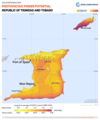
 Trinidad-and-Tobago GHI Solar-resource-map GlobalSolarAtlas World-Bank-Esmap-Solargis.png 1,842 × 2,209; 1.34 MB
-
-
 Trinidad-et-Tobago carte fr.png 342 × 367; 9 KB
-
 TTBasin USGS.JPG 544 × 620; 56 KB
-
 TTOilandGas.JPG 709 × 654; 76 KB


