Category:Maps of Town of Hempstead, New York
Jump to navigation
Jump to search
Use the appropriate category for maps showing all or a large part of Hempstead. See subcategories for smaller areas:
| If the map shows | Category to use |
|---|---|
| Hempstead on a recently created map | Category:Maps of Town of Hempstead, New York or its subcategories |
| Hempstead on a map created more than 70 years ago | Category:Old maps of Town of Hempstead, New York or its subcategories |
| the history of Hempstead on a recently created map | Category:Maps of the history of Town of Hempstead, New York or its subcategories |
| the history of Hempstead on a map created more than 70 years ago | Category:Old maps of the history of Town of Hempstead, New York or its subcategories |
Subcategories
This category has only the following subcategory.
Media in category "Maps of Town of Hempstead, New York"
The following 17 files are in this category, out of 17 total.
-

-

-

-

-

-

-
 Cedarhurst NYPL1633795.tiff 7,230 × 4,468; 92.42 MB
-

-
 East-atlantic-beach-map.png 575 × 425; 22 KB
-
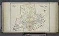
 Hempstead, N.Y. Long Island, 1876 (NYPL Hades-118936-55087).tif 5,883 × 4,992; 84.19 MB
-
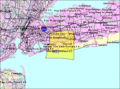 Hempstead-town-map.gif 575 × 425; 67 KB
-

-

-
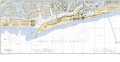 JONES INLET.png 8,100 × 4,188; 1.24 MB
-

-
 South-hempstead-ny-map.gif 575 × 425; 61 KB
-
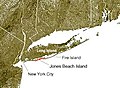 Wpdms ev26188 jones beach island.jpg 300 × 220; 31 KB


.png)
.png)


.png)


