Category:Maps of Tintin
Jump to navigation
Jump to search
Media in category "Maps of Tintin"
The following 9 files are in this category, out of 9 total.
-
 LocationBorduria.png 250 × 115; 6 KB
-
 Borduria-map.PNG 252 × 117; 6 KB
-
 Bordúria Map.jpg 1,019 × 855; 160 KB
-
 Hypothèse de trajet suivi par Tintin au Pérou dans l'album "Le Temple du Soleil".png 2,970 × 2,099; 6.87 MB
-
 Mapa Nuevo Rico.png 975 × 649; 86 KB
-
 Mapa San Teodoro.png 975 × 649; 86 KB
-
 Syldavia Map.jpg 1,019 × 855; 161 KB
-
 LocationSyldavia.png 250 × 115; 6 KB
-
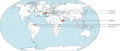 World Map of Tintin.png 1,232 × 528; 428 KB


